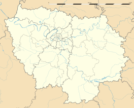
Crécy-la-Chapelle
| Crécy-la-Chapelle | |
|---|---|
 |
|
| Coordinates: 48°51′23″N 2°54′40″E / 48.8563°N 2.911°ECoordinates: 48°51′23″N 2°54′40″E / 48.8563°N 2.911°E | |
| Country | France |
| Region | Île-de-France |
| Department | Seine-et-Marne |
| Arrondissement | Meaux |
| Canton | Serris |
| Intercommunality | Pays Créçois |
| Government | |
| • Mayor (2015–2020) | Bernard Carouge |
| Area1 | 15.78 km2 (6.09 sq mi) |
| Population (2006)2 | 4,096 |
| • Density | 260/km2 (670/sq mi) |
| Time zone | CET (UTC+1) |
| • Summer (DST) | CEST (UTC+2) |
| INSEE/Postal code | 77142 /77580 |
| Elevation | 45–157 m (148–515 ft) |
|
1 French Land Register data, which excludes lakes, ponds, glaciers > 1 km² (0.386 sq mi or 247 acres) and river estuaries. 2Population without double counting: residents of multiple communes (e.g., students and military personnel) only counted once. |
|
1 French Land Register data, which excludes lakes, ponds, glaciers > 1 km² (0.386 sq mi or 247 acres) and river estuaries.
Crécy-la-Chapelle is a commune in the Seine-et-Marne department in the Île-de-France region in north-central France.
Crécy-la-Chapelle is crossed by the river Grand Morin. The ground of the area is limestone.
Crécy Bourg, Montbarbin, Serbonne, la Chapelle-sur-Crécy, Libernon, Mongrolle, Férolles, Montaudier, la Grand-Cour, les Hauts-Soleil, le Choisiel, le Souterain, Montpichet
The inhabitants are called Créçois.
The town is twinned with Pielenhofen ![]()
House where lived the artist Corot.
Wall walk.
Belfry dating from the 19th century built on a tower dating from 12th century.
War memorial.
Vestige of the delivery service.
...
Wikipedia


