Cove
| Cové | |
|---|---|
| Commune and city | |
 |
|
| Location in Benin | |
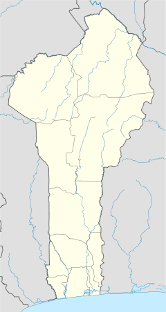
| Coordinates: 7°14′N 2°18′E / 7.233°N 2.300°E | |
| Country |
|
| Department | Zou Department |
| Area | |
| • Total | 525 km2 (203 sq mi) |
| Population (2012) | |
| • Total | 43,554 |
| • Density | 83/km2 (210/sq mi) |
| Time zone | WAT (UTC+1) |
Cové is a city located in the Zou Department of Benin. The commune covers an area of 525 square kilometres and as of 2012 had a population of 43,554 people.
Cové is located 40 kilometres from Abomey and 159 kilometres from Cotonou. The commune covers an area of 525 square kilometres and the Zou Ouémé river passes through it. It is bounded to the north by Dassa-Zoumé, east by Zagnanado, south by Zogbodomey, and west by Djidja and Za-Kpota. It is linked to the capital by a paved road. Cové became a sub-prefecture in 1991.
Cové is subdivided into 7 arrondissements; Adogbé, Gounli, Houin, Lainta, Naogon, Soli and Zogba. They contain 36 quartiers.
The main ethnic groups are the Mahi, the Fon, Yoruba, Dendi and Bariba. The occupations of the inhabitants are agriculture, fishing and hunting (42%), trade and catering (30%), transport and communication (6%) crafts (11%) etc. 53 600,00 hectares of land are devoted to agriculture, accounting for 93.38% of the total population. The main crops grown are maize, cotton, peanuts, cassava and rice.
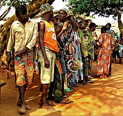
The Gelede Masked Festival of the Yoruba people is prominent in Cové. It is a performance in honor of the dangerous and creative powers of women elders, attempting to ingratiate with Nla, the first female of the Yoruba Universe. It relays the virtues and responsibilities of society, advocating a particular respect for motherhood. The tradition dates back to the 15th century and only men initiated into a ‘secret society’ can perform the dances, but will represent both men and women.
...
Wikipedia

