Corbin, KY
| Corbin, Kentucky | |
|---|---|
| City | |

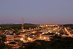
Downtown area, 2011
|
|
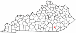
 Location of Corbin, Kentucky |
|
| Coordinates: 36°56′30″N 84°5′44″W / 36.94167°N 84.09556°WCoordinates: 36°56′30″N 84°5′44″W / 36.94167°N 84.09556°W | |
| Country | United States |
| State | Kentucky |
| Counties | Whitley, Knox, Laurel |
| Government | |
| • Mayor | Willard McBurney |
| Area | |
| • Total | 7.9 sq mi (20.6 km2) |
| • Land | 7.9 sq mi (20.4 km2) |
| • Water | 0.0 sq mi (0.1 km2) |
| Elevation | 1,079 ft (329 m) |
| Population (2012) | |
| • Total | 7,272 |
| • Density | 920.1/sq mi (355.3/km2) |
| Time zone | Eastern (EST) (UTC-5) |
| • Summer (DST) | EDT (UTC-4) |
| ZIP codes | 40701-40702 |
| Area code(s) | 606 |
| FIPS code | 21-17362 |
| GNIS feature ID | 0511536 |
| Website | corbin-ky.gov |
Corbin is a home rule-class city in Whitley and Knox counties in the southeastern portion of the U.S. state of Kentucky. The urbanized area around Corbin extends into Laurel County; this area is not incorporated into the city limits due to a state law prohibiting cities from being in more than two counties. However, this area is served by some of the city's public services. As of the 2010 census, the city population was 7,304, with 21,132 living in the "urban cluster" that includes Corbin and North Corbin.
The first settlement in the Corbin area was known as Lynn Camp Station and the first post office was called Cummins for community founder Nelson Cummins. It was discovered in 1885 that both Cummins and Lynn Camp were already in use as names for Kentucky post offices and postmaster James Eaton was asked to select another name. He chose Corbin, for the Rev. James Corbin Floyd, a local minister. The town was incorporated under that name in 1905.
Corbin has a somewhat troubled racial past, including a race riot in 1919 in which a white mob forced nearly all the town's 200 black residents onto a freight train out of town, and a sundown town policy until the late 20th century.
According to the United States Census Bureau, it has a total area of 7.9 sq mi (20 km2), with only a tiny fraction of 0.044 sq mi (0.11 km2), or 0.56%, consisting of water.
Corbin lies in the Cumberland Plateau region of Appalachia in southeastern Kentucky. The Pine Mountain Overthrust Fault, a geologic fault system located several miles to the east, produces occasional tremors, the most recent in 2008.
Corbin exhibits a humid subtropical climate, typical of southeastern Kentucky. The region experiences four distinct seasons, Winters are cool to cold, with mild periods. Summers are generally hot and humid, with variable spring and fall seasons. Precipitation is common year round, but more prevalent in the summer months. The climate of Corbin is somewhat moderated by the surrounding mountains.
...
Wikipedia
