Laurel County, Kentucky
| Laurel County, Kentucky | |
|---|---|

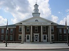
Laurel County courthouse in London
|
|
 Location in the U.S. state of Kentucky |
|
 Kentucky's location in the U.S. |
|
| Founded | December 21, 1825 |
| Named for | Mountain laurel trees |
| Seat | London |
| Largest city | London |
| Area | |
| • Total | 444 sq mi (1,150 km2) |
| • Land | 434 sq mi (1,124 km2) |
| • Water | 9.7 sq mi (25 km2), 2.2% |
| Population | |
| • (2010) | 58,849 |
| • Density | 136/sq mi (53/km²) |
| Congressional district | 5th |
| Time zone | Eastern: UTC-5/-4 |
Laurel County is a county in the U.S. state of Kentucky. As of the 2010 census, the population was 58,849. Its county seat is London.
Laurel County is included in the London, KY Micropolitan Statistical Area.
Laurel County, by-the-drink alcohol sales is permitted only in restaurants in the city of London seating at least 50 diners and deriving at least 50% of their total sales from food.
Laurel County, the 80th county to be organized in Kentucky, was established by an act of the general assembly, December 21, 1825, from parts of Rockcastle, Clay, Knox and Whitley Counties. Laurel County was named from the Laurel River, noted for dense laurel thickets along its banks.
Laurel County was the location of the Battle of Wildcat Mountain, a pivotal yet little known battle during the American Civil War that kept Confederate armies from advancing on Big Hill, a major stronghold during the war.
After a fire damaged the courthouse in 1958, a new structure was completed in 1961.
The first Kentucky Fried Chicken was started in Laurel County in Colonel Harland Sanders hometown of North Corbin. Due to the history of chicken in the county, The World Chicken Festival is celebrated every year in Laurel County, drawing crowds of up to 250,000 people over the four-day festival.
According to the U.S. Census Bureau, the county has a total area of 444 square miles (1,150 km2), of which 434 square miles (1,120 km2) is land and 9.7 square miles (25 km2) (2.2%) is water. Part of Laurel River Lake is in Laurel County.
As of the census of 2000, there were 52,715 people, 20,353 households, and 15,366 families residing in the county. The population density was 121 per square mile (47/km2). There were 22,317 housing units at an average density of 51 per square mile (20/km2). The racial makeup of the county was 95.66% White, 1.63% Black or African American, 0.37% Native American, 0.35% Asian, 0.01% Pacific Islander, 0.08% from other races, and 0.90% from two or more races. 0.55% of the population were Hispanics or Latinos of any race.
...
Wikipedia
