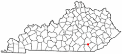
North Corbin, Kentucky
| North Corbin, Kentucky | |
|---|---|
| CDP | |
 Location of North Corbin, Kentucky |
|
| Coordinates: 36°57′38″N 84°5′38″W / 36.96056°N 84.09389°WCoordinates: 36°57′38″N 84°5′38″W / 36.96056°N 84.09389°W | |
| Country | United States |
| State | Kentucky |
| Counties | Laurel, Knox |
| Area | |
| • Total | 1.8 sq mi (4.7 km2) |
| • Land | 1.8 sq mi (4.7 km2) |
| • Water | 0.0 sq mi (0.0 km2) |
| Elevation | 1,109 ft (338 m) |
| Population (2010) | |
| • Total | 1,779 |
| • Density | 913.4/sq mi (352.7/km2) |
| Time zone | Eastern (EST) (UTC-5) |
| • Summer (DST) | EDT (UTC-4) |
| FIPS code | 21-56694 |
| GNIS feature ID | 0514286 |
North Corbin is a census-designated place (CDP) in Knox and Laurel counties in the U.S. state of Kentucky. The population was 1,779 at the 2010 census. The city of Corbin is located south of North Corbin.
The Harland Sanders Café and Museum, the restaurant where Colonel Harland Sanders developed the fried chicken recipe that would later become famous as Kentucky Fried Chicken, is located in the Laurel County portion of North Corbin.
North Corbin is located at 36°57′38″N 84°5′38″W / 36.96056°N 84.09389°W (36.960433, -84.093867). According to the United States Census Bureau, the CDP has a total area of 1.8 square miles (4.7 km²), all land.
As of the census of 2000, there were 1,662 people, 689 households, and 469 families residing in the CDP. The population density was 913.4 people per square mile (352.6/km²). There were 774 housing units at an average density of 425.4/sq mi (164.2/km²). The racial makeup of the CDP was 97.41% White, 0.06% African American, 0.60% Native American, 0.24% Pacific Islander, 0.06% from other races, and 1.62% from two or more races. Hispanic or Latino of any race were 0.06% of the population.
...
Wikipedia
