Clymer, New York
| Clymer, New York | |
|---|---|
| Town | |

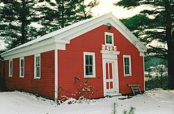
Little Red Schoolhouse in 1997
|
|
 Location within Chautauqua County and New York |
|
| Location within the state of New York | |
| Coordinates: 42°2′7″N 79°35′17″W / 42.03528°N 79.58806°W | |
| Country | United States |
| State | New York |
| County | Chautauqua |
| Government | |
| • Type | Town Council |
| • Town Supervisor | Ralph J. Holthouse (R) |
| • Town Council |
Members' List
|
| Area | |
| • Total | 36.2 sq mi (93.7 km2) |
| • Land | 36.1 sq mi (93.4 km2) |
| • Water | 0.08 sq mi (0.2 km2) |
| Elevation | 1,480 ft (451 m) |
| Population (2010) | |
| • Total | 1,698 |
| • Density | 47/sq mi (18.2/km2) |
| Time zone | Eastern (EST) (UTC-5) |
| • Summer (DST) | EDT (UTC-4) |
| ZIP code | 14724 |
| Area code(s) | 716 Exchange: 355 |
| FIPS code | 36-16595 |
| GNIS feature ID | 0978842 |
| Website | townofclymer |
Clymer is a town in Chautauqua County, New York, United States. The population was 1,698 at the 2010 census. The town is named for George Clymer, a signer of the Declaration of Independence. Clymer is located in the southwest part of the county.
Settlement began around 1820. The town of Clymer was established in 1829 from a division of the town of Chautauqua. In 1821, a division of Clymer was made to form the new town of Mina and again in 1829 to form the town of French Creek. In 1915, the population of Clymer was 1,341.
Neckers Co., a general store, has occupied the northwest corner of the main intersection in town since 1910, passing through four generations of the Neckers family.
The Clymer District School No. 5 was listed on the National Register of Historic Places in 1994.
On or about September 24, 2012, Clymer Central School superintendent Keith Reed Jr. was shot to death by an apparent murderer on his property near Clymer.
Clymer has been a dry town since 1974.
According to the United States Census Bureau, the town has a total area of 36.2 square miles (93.7 km2), of which 36.1 square miles (93.4 km2) is land and 0.08 square miles (0.2 km2), or 0.26%, is water.
New York State Route 474 passes through the town and intersects New York State Route 76 in North Clymer.
Clymer borders Wayne Township, Erie County, Pennsylvania, and Columbus Township, Warren County, Pennsylvania, to the south. The town of French Creek is to the west and the town of Harmony is to the east. The town of Sherman is north of Clymer.
...
Wikipedia

