Clarendon, Vermont
| Clarendon, Vermont | |
|---|---|
| Town | |
 Clarendon, Vermont |
|
| Coordinates: 43°32′N 72°58′W / 43.533°N 72.967°WCoordinates: 43°32′N 72°58′W / 43.533°N 72.967°W | |
| Country | United States |
| State | Vermont |
| County | Rutland |
| Area | |
| • Total | 31.6 sq mi (81.7 km2) |
| • Land | 31.6 sq mi (81.7 km2) |
| • Water | 0.0 sq mi (0.0 km2) |
| Elevation | 538 ft (164 m) |
| Population (2010) | |
| • Total | 2,571 |
| • Density | 81/sq mi (31/km2) |
| Time zone | Eastern (EST) (UTC-5) |
| • Summer (DST) | EDT (UTC-4) |
| ZIP code | 05759 |
| Area code(s) | 802 |
| FIPS code | 50-14500 |
| GNIS feature ID | 1462072 |
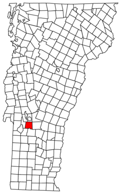
Clarendon is a town in Rutland County, Vermont, United States. The population was 2,571 at the 2010 census. Clarendon spans U.S. Route 7 and is split by the highway, the Cold River and Mill River, Otter Creek, and the Green Mountains into the villages of Clarendon, West Clarendon, East Clarendon, Clarendon Springs, and North Clarendon.
The area that later formed the Town of Clarendon was settled by families from lower New England as early as 1762. It and the surrounding area was then part of Albany County, New York, but was later split off as Charlotte County until Vermont declared itself as a republic around 1788. Land claims by New Hampshire were eventually settled, and in 1791 Vermont became a state.
Clarendon now includes the following entries on the National Register of Historic Places:
Clarendon Congregational Church
Clarendon House, Clarendon Springs
Former East Clarendon Railroad Station
Kingsley Covered Bridge, East Clarendon
According to the United States Census Bureau, the town has a total area of 31.6 square miles (81.7 km2), all land.
The Clarendon Gorge, accessible using the combined Appalachian Trail/Long Trail, is a popular local geographical feature. One must cross a 30-foot-long (9.1 m) suspension bridge to reach the waterfall and swimming holes as well as to connect with the Appalachian Trail National Scenic Trail.
...
Wikipedia
