Long Trail
| Long Trail | |
|---|---|

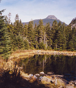
Camel's Hump from the Long Trail
|
|
| Length | 273 mi (439 km) |
| Location | Vermont, United States |
| Use | Hiking, Snowshoeing |
| Elevation | |
| Highest point | Mount Mansfield |
| Lowest point | Winooski River at Jonesville |
| Hiking details | |
| Trail difficulty | Moderate to Strenuous |
| Season | Late spring through late fall |
The Long Trail is a hiking trail located in Vermont, running the length of the state. It is the oldest long-distance trail in the United States, constructed between 1910 and 1930 by the Green Mountain Club. The club remains the primary organization responsible for the trail, and is recognized by the state legislature as "the founder, sponsor, defender, and protector" of the Long Trail System.
The Long Trail was conceived on March 11, 1910 by James P. Taylor who was at the time the Assistant Headmaster of Vermont Academy in Saxtons River, Vermont. Taylor lobbied other Vermont residents who shared his dream of a mission to "make the Vermont mountains play a larger part in the life of the people by protecting and maintaining the Long Trail system and fostering, through education, the stewardship of Vermont's hiking trails and mountains". In 1910, work began on the construction of America's first long-distance hiking path. The GMC completed the Long Trail in 1930.
The Long Trail runs 273 miles (439 km) through the state of Vermont. It starts at the Massachusetts state line (near Williamstown, Massachusetts), and runs north to the Canada–US border (near North Troy, Vermont). It runs along the main ridge of the Green Mountains, coinciding with the Appalachian Trail for 100 miles (160 km) in southern Vermont. Additionally, over 175 miles (282 km) of side trails complete the Long Trail System.
The Long Trail traverses almost all of the Green Mountains' major summits, including (from south to north) Glastenbury Mountain, Stratton Mountain, Killington Peak, Mount Abraham, Mount Ellen, Camel's Hump, Mount Mansfield, and Jay Peak.
...
Wikipedia
