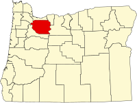
Clackamas County, Oregon
| Clackamas County, Oregon | ||
|---|---|---|

Clackamas County Courthouse in Oregon City
|
||
|
||
 Location in the U.S. state of Oregon |
||
 Oregon's location in the U.S. |
||
| Founded | July 5, 1843 | |
| Seat | Oregon City | |
| Largest city | Lake Oswego | |
| Area | ||
| • Total | 1,883 sq mi (4,877 km2) | |
| • Land | 1,870 sq mi (4,843 km2) | |
| • Water | 13 sq mi (34 km2), 0.7% | |
| Population (est.) | ||
| • (2015) | 401,515 | |
| • Density | 201/sq mi (78/km²) | |
| Congressional districts | 3rd, 5th | |
| Time zone | Pacific: UTC-8/-7 | |
| Website | www |
|
Clackamas County /ˈklækəmᵻs/ is a county in the U.S. state of Oregon. As of the 2010 census, the population was 375,992, making it Oregon's third-most populous county. Its county seat is Oregon City. The county was named after the Native Americans living in the area, the Clackamas Indians, who were part of the Chinookan people.
Clackamas County is part of the Portland-Vancouver-Hillsboro, OR-WA Metropolitan Statistical Area. It is in the Willamette Valley.
Originally named Clackamas District, it was one of the four original Oregon districts created by Oregon's Provisional Legislature on July 5, 1843 along with Twality (later Washington), Champooick (later Marion), and Yamhill. The four districts were redesignated as counties in 1845. At the time of its creation, Clackamas County covered portions of four present-day U.S. states and a Canadian province. The Columbia River became the northern boundary of the county in 1844. Soon after John McLoughlin staked a land claim in Oregon City and built a house that in 2003 became a unit of the Fort Vancouver National Historic Site.
...
Wikipedia

