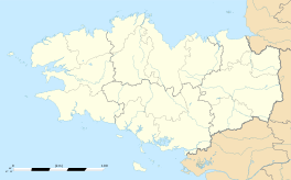
Cléder
|
Cléder Kleder |
||
|---|---|---|

Les Amiets beach
|
||
|
||
| Coordinates: 48°39′51″N 4°06′03″W / 48.6642°N 4.1008°WCoordinates: 48°39′51″N 4°06′03″W / 48.6642°N 4.1008°W | ||
| Country | France | |
| Region | Brittany | |
| Department | Finistère | |
| Arrondissement | Morlaix | |
| Canton | Plouzévédé | |
| Intercommunality | Baie du Kernic | |
| Government | ||
| • Mayor (2014–2020) | Gérard Daniélou | |
| Area1 | 37.44 km2 (14.46 sq mi) | |
| Population (2008)2 | 3,814 | |
| • Density | 100/km2 (260/sq mi) | |
| Time zone | CET (UTC+1) | |
| • Summer (DST) | CEST (UTC+2) | |
| INSEE/Postal code | 29030 /29233 | |
| Elevation | 0–79 m (0–259 ft) | |
|
1 French Land Register data, which excludes lakes, ponds, glaciers > 1 km² (0.386 sq mi or 247 acres) and river estuaries. 2Population without double counting: residents of multiple communes (e.g., students and military personnel) only counted once. |
||
1 French Land Register data, which excludes lakes, ponds, glaciers > 1 km² (0.386 sq mi or 247 acres) and river estuaries.
Cléder (Breton: Kleder) is a commune in the Finistère department of Brittany in north-western France.
Inhabitants of Cléder are called in French Clédérois.
In 2008, 25.9% of primary-school children attended bilingual schools.
Cléder is twinned with Ashburton![]() , Herleshausen
, Herleshausen![]() and Taninges
and Taninges![]() .
.
...
Wikipedia


