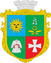
Chemerivtsi
|
Chemerivtsi Чемерівці |
|||
|---|---|---|---|
| Urban-type settlement | |||
|
|||
| Coordinates: 49°00′44″N 26°21′11″E / 49.01222°N 26.35306°ECoordinates: 49°00′44″N 26°21′11″E / 49.01222°N 26.35306°E | |||
| Country |
|
||
| Province | Khmelnytskyi Oblast | ||
| District | Chemerivtsi Raion | ||
| Founded | 1565 | ||
| Town status | 1959 | ||
| Government | |||
| • Town Head | Volodymyr Voitov | ||
| Area | |||
| • Total | 5.61 km2 (2.17 sq mi) | ||
| Elevation | 278 m (912 ft) | ||
| Population (2011) | |||
| • Total |
|
||
| Time zone | EET (UTC+2) | ||
| • Summer (DST) | EEST (UTC+3) | ||
| Postal code | 31600—31607 | ||
| Area code | +380 3859 | ||
| Website | http://rada.gov.ua/ | ||
Chemerivtsi (Ukrainian: Чемерівці) is an urban-type settlement in Khmelnytskyi Oblast (province) in western Ukraine. It serves as the administrative center of the Chemerivtsi Raion (district), housing the district's local administration buildings. The town's population was 5,431 as of the 2001 Ukrainian Census and 5,399 in 2011.
Chemerivtsi was first founded in 1565 and it received the Magdeburg rights in 1797. It received the status of an urban-type settlement in 1959.
...
Wikipedia


