Chaykovsky, Perm Krai
| Chaykovsky (English) Чайковский (Russian) |
|
|---|---|
| - Town - | |
 Aerial view of Chaykovsky |
|
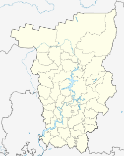
 Location of Perm Krai in Russia |
|
|
|
|
|
|
|
|
|
|
| Administrative status (as of June 2014) | |
| Country | Russia |
| Federal subject | Perm Krai |
| Administratively subordinated to | town of krai significance of Chaykovsky |
| Administrative center of | town of krai significance of Chaykovsky |
| Municipal status (as of December 2013) | |
| Municipal district | Chaykovsky Municipal District |
| Urban settlement | Chaykovskoye Urban Settlement |
| Administrative center of | Chaykovsky Municipal District, Chaykovskoye Urban Settlement |
| Head | Alexey Tretyakov |
| Statistics | |
| Area (Chaykovskoye Urban Settlement) (December 2009) | 56.49 km2 (21.81 sq mi) |
| Population (2010 Census) | 82,895 inhabitants |
| - Rank in 2010 | 200th |
| Density | 1,467/km2 (3,800/sq mi) |
| Time zone | YEKT (UTC+05:00) |
| Founded | 1955 |
| Town status since | 1962 |
| Postal code(s) | 617760-617766, 617769 |
| Dialing code(s) | +7 34241 |
|
|
|
| on | |
Chaykovsky (Russian: Чайко́вский) is a town in Perm Krai, Russia, located on the Kama River 325 kilometers (202 mi) southwest of Perm, the administrative center of the krai. Population: 82,895 (2010 Census); 86,714 (2002 Census);85,849 (1989 Census).
The town is named after the Russian composer Pyotr Ilyich Tchaikovsky, who was born in the nearby town of Votkinsk.
The town is located in the Cis-Ural region on left bank of the Kama River, near its confluence with the Saygatka in the southwestern part of Perm Krai. The confluence of the Kama and the Saygatka and the nearby Votkinsk Reservoir form a peninsula on which the town is located.
The area of Chaykovskoye Urban Settlement is 56.49 square kilometers (21.81 sq mi) (including the water surface), while the аrea of the town proper is about 31 square kilometers (12 sq mi).
Chaykovskoye Urban Settlement borders with Yelovsky District in the north, Vankovsky Rural Settlement in the northeast, Fokinsky and Bolshe-Bukorsky Rural Settlements in the east, Olkhovsky Rural Settlement in the south, and with Votkinsky District of the Udmurt Republic in the west.
It was founded in 1955 as a settlement serving the construction of Votkinsk's hydroelectric power station. The village of Saygatka, known since 1646, used to occupy the place where Chaykovsky now stands. In 1956, Chaykovsky was granted urban-type settlement status, and in 1962, it was granted town status.
...
Wikipedia


