Changi Airport MRT Station
| Rapid transit | |||||||||||

Changi Airport station platform level.
|
|||||||||||
| Location | 70 Airport Boulevard Singapore 819661 |
||||||||||
| Coordinates | 1°21′26.54″N 103°59′19.81″E / 1.3573722°N 103.9888361°E | ||||||||||
| Operated by | SMRT Trains (SMRT Corporation) | ||||||||||
| Line(s) | |||||||||||
| Platforms | Island | ||||||||||
| Tracks | 2 | ||||||||||
| Connections | Bus, Taxi | ||||||||||
| Construction | |||||||||||
| Structure type | Underground | ||||||||||
| Platform levels | 3 (excluding street level) | ||||||||||
| Parking | Yes (Changi Airport) | ||||||||||
| Bicycle facilities | Yes (Changi Airport) | ||||||||||
| Disabled access | Yes | ||||||||||
| Other information | |||||||||||
| Station code | CG2 | ||||||||||
| History | |||||||||||
| Opened | 27 February 2002 | ||||||||||
| Electrified | Yes | ||||||||||
| Services | |||||||||||
|
|||||||||||
| Location | |||||||||||
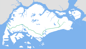
Changi Airport MRT Station (CG2) is an underground Mass Rapid Transit terminal station on the East West Line in Changi, Singapore. The station is located within Singapore Changi Airport, hence its name.
The station was opened on 25 February 2002, while the ceremony held on 27 February 2002 by the then Minister for Transport, Mr Yeo Cheow Tong as one of the terminal Mass Rapid Transit (MRT) stations for the East West Line, and located in between Singapore Changi Airport's Terminal 2 and Terminal 3.
Changi Airport had been operating since its opening in 1981 with no rail link and with full reliance on taxi and bus connections, proven effective given the short 20 kilometre distance to the city via the East Coast Parkway and their relative affordability. Public buses also provide cheap express trips to the city, and link commuters to the MRT network at Bedok, Tampines and Pasir Ris. There was thus no pressing need to build the rail line despite regional competition, and was only given the green light when the Singapore Expo was built along the line and helping to add potential traffic.
The earlier plans had long been made for a new line branching off from the existing East West Line at Tanah Merah, with some conceptual plans showing a tentative route alignment up to the airport along Airport Boulevard, continuing beyond the airport to Changi Point, before turning southwest back towards the city along the east coast of the island. When the extension to the airport was finally announced, however, the route alignment showed a deviation from previous plans.
...
Wikipedia

