Cecil County, Maryland
| Cecil County, Maryland | ||
|---|---|---|
| County | ||
| Cecil County | ||
|
||
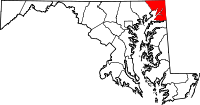
 Location in the U.S. state of Maryland |
||
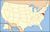
 Maryland's location in the U.S. |
||
| Founded | June 6, 1674 | |
| Named for | Cecil Calvert | |
| Seat | Elkton | |
| Largest town | Elkton | |
| Area | ||
| • Total | 418 sq mi (1,083 km2) | |
| • Land | 346 sq mi (896 km2) | |
| • Water | 72 sq mi (186 km2), 17% | |
| Population (est.) | ||
| • (2015) | 102,382 | |
| • Density | 245/sq mi (95/km²) | |
| Congressional district | 1st | |
| Time zone | Eastern: UTC-5/-4 | |
| Website | www |
|
Cecil County is a county located in the U.S. state of Maryland. As of the 2010 census, the population was 101,108. The county seat is Elkton. The county was named for Cecil Calvert, 2nd Baron Baltimore (1605–1675), the first Proprietary Governor of the Province (colony) of Maryland. It is the only Maryland county that is part of the Philadelphia-Camden-Wilmington, PA-NJ-DE-MD Metropolitan Statistical Area
The area now known as Cecil County was an important trading center long before the county's official organization in 1674 by proclamation of Lord Baltimore. It had previously been a northeastern part of a much larger Baltimore County, in the northeastern portion of the Province. This had included present-day Baltimore City and county, Carroll, eastern Frederick, and portions of Howard and Anne Arundel counties. At the time of its founding, Cecil County also included modern Kent County and the border on the Eastern Shore of the Chesapeake Bay went as far south as the Chester River, until its later formation in 1706. The Piscataway traded with the Susquehannocks near Conowingo, and with Lenape of the Delaware valley and their Nanticoke allies near the Elk River and Elk Neck Peninsula. A southern tribe sometimes called the Shawnace also moved into what later became North East, Maryland.Captain John Smith visited the area in 1608. William Claiborne, a Puritan trader based in Virginia, earlier established a trading post at what is now known as Garrett island at the mouth of the Susquehanna River near what became Perryville. Bohemian immigrant Augustine Herman lobbied for Cecil County's creation, and drew the 1674 maps, in exchange for which Herman received extensive land grants, including one developed as Bohemia Manor, where he eventually died. Another early developer was George Talbot, appointed Surveyor-General of Maryland in 1683, who came from Ballyconnell, County Cavan, Ireland.
...
Wikipedia

