Baltimore County
| Baltimore County, Maryland | |||
|---|---|---|---|
| County | |||
| Baltimore County | |||

The Baltimore County Courthouse
|
|||
|
|||
| Nickname(s): "B-More County", "The County" | |||
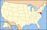
 Location in the U.S. state of Maryland |
|||
 Maryland's location in the U.S. |
|||
| Founded | June 30, 1659 | ||
| Named for | Cecil Calvert, 2nd Baron Baltimore | ||
| Seat | Towson | ||
| Largest community | Dundalk | ||
| Area | |||
| • Total | 682 sq mi (1,766 km2) | ||
| • Land | 598 sq mi (1,549 km2) | ||
| • Water | 83 sq mi (215 km2), 12% | ||
| Population (est.) | |||
| • (2015) | 831,128 | ||
| • Density | 1,219/sq mi (471/km²) | ||
| Congressional districts | 1st, 2nd, 3rd, 7th | ||
| Time zone | Eastern: UTC-5/-4 | ||
| Website | www |
||
Coordinates: 39°24′N 76°36′W / 39.400°N 76.600°W
Baltimore County is located in northern Maryland, USA. It is the state's third-most populous county. Its county seat is in Towson, just north of Baltimore. The name of the county derives from Cecil Calvert, 2nd Baron Baltimore (1605–1675), the proprietor of the new colony in the Province of Maryland, and the town of Baltimore in County Cork, Ireland.
Baltimore County is part of the Baltimore metropolitan area and Washington metropolitan area. The county is also part of the Northeast Megalopolis stretching from Boston to Washington, D.C.
The town of Baltimore became the county seat of Baltimore County in 1767. The town annexed several parcels of land and in 1851 separated from the county with the adoption of the second Maryland state constitution. Baltimore became one of the few "independent cities" in the United States, putting it on the same level with other 23 counties of the state and granting limited "home rule" powers outside the authority of the General Assembly of Maryland.
...
Wikipedia


