Carrollton, Mississippi
| Carrollton, Mississippi | |
|---|---|
| Town | |

Carroll County Courthouse in Carrollton
|
|
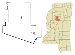
 Location of Carrollton, Mississippi |
|
| Coordinates: 33°30′18″N 89°55′22″W / 33.50500°N 89.92278°WCoordinates: 33°30′18″N 89°55′22″W / 33.50500°N 89.92278°W | |
| Country | United States |
| State | Mississippi |
| County | Carroll |
| Area | |
| • Total | 0.8 sq mi (2.0 km2) |
| • Land | 0.8 sq mi (2.0 km2) |
| • Water | 0.0 sq mi (0.0 km2) |
| Elevation | 289 ft (88 m) |
| Population (2010) | |
| • Total | 190 |
| • Density | 243/sq mi (94.0/km2) |
| Time zone | Central (CST) (UTC-6) |
| • Summer (DST) | CDT (UTC-5) |
| ZIP code | 38917 |
| Area code(s) | 662 |
| FIPS code | 28-11580 |
| GNIS feature ID | 0668097 |
| Website | www |
Carrollton is a town in and the county seat of Carroll County, Mississippi, United States. The population was 190 at the 2010 census, down from 408 in 2000. The only incorporated place in Mississippi with a lower population is Walthall (population: 144), the county seat of Webster County. It is part of the Greenwood, Mississippi micropolitan area.
As of July 23, 2016, Carrollton still flies, at full mast, the Confederate Battle Flag, The Battle Flag of the Army of Northern Virginia, above the county memorial to the Confederate dead.
Carrollton is located in central Carroll County on the south side of Big Sand Creek, a tributary of the Yalobusha River. According to the United States Census Bureau, Carrollton has a total area of 0.8 square miles (2.1 km2), all land.
The town borders North Carrollton, which is located directly to the north across the creek. Mississippi Highways 17 and 35 pass through the center of Carrollton, leading north into North Carrollton. Many residents of Carrollton and North Carrollton consider the towns a single entity, simply referred to as Carrollton.
Highway 35 continues north 21 miles (34 km) to Holcomb; in the other direction, it leads southeast 18 miles (29 km) to Vaiden, the other county seat. Highway 17 leads south 30 miles (48 km) to Lexington. U.S. Route 82, a four-lane divided highway, passes through the southern part of Carrollton, leading east 11 miles (18 km) to Winona and west 18 miles (29 km) to Greenwood.
As of the census of 2000, there were 408 people, 85 households, and 62 families residing in the town. The population density was 522.0 people per square mile (202.0/km²). There were 99 housing units at an average density of 126.7 per square mile (49.0/km²). The racial makeup of the town was 50.00% White and 50.00% African American. Hispanic or Latino of any race were 0.49% of the population.
...
Wikipedia
