Lexington, Mississippi
| Lexington, Mississippi | |
|---|---|
| City | |

St. Mary's Episcopal Church
|
|
| Nickname(s): L-Town | |
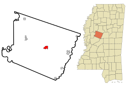
 Location of Lexington, Mississippi |
|
| Location in the United States | |
| Coordinates: 33°6′52″N 90°3′4″W / 33.11444°N 90.05111°WCoordinates: 33°6′52″N 90°3′4″W / 33.11444°N 90.05111°W | |
| Country | United States |
| State | Mississippi |
| County | Holmes |
| Government | |
| • Mayor | Clint Cobbins |
| Area | |
| • Total | 2.5 sq mi (6.4 km2) |
| • Land | 2.5 sq mi (6.4 km2) |
| • Water | 0.0 sq mi (0.0 km2) |
| Elevation | 233 ft (71 m) |
| Population (2000) | |
| • Total | 2,025 |
| • Density | 825.6/sq mi (318.8/km2) |
| Time zone | Central (CST) (UTC-6) |
| • Summer (DST) | CDT (UTC-5) |
| ZIP code | 39095 |
| Area code(s) | 662 |
| FIPS code | 28-40600 |
| GNIS feature ID | 0672434 |
Lexington is a city in and the county seat of Holmes County, Mississippi. The county was organized in 1833 and the city in 1836.
The population was 2,025 at the 2000 census and estimated at 1,609 in 2015. It has declined with the growth of industrial agriculture. Many people have left the rural county to seek work elsewhere.
Incorporated in 1836, the city of Lexington was founded by European-American settlers after most of the Choctaw people, who had long occupied this area, were forced to cede their land to the United States and remove to the Indian Territory. The new settlers initially developed riverfront land along the Yazoo and Black rivers for cotton plantations, primarily worked by enslaved African Americans. The slaves were brought by planters with them from the Upper South or transported in the domestic slave trade. In total, more than one million African Americans were transported to the Deep South, breaking up many families. The African-descended slaves soon constituted the majority of the Holmes County population.
On court days, the town served as a trading center for the county and attracted retail merchants. Lexington was a destination in the 1830s of some German-Jewish immigrants, who often became merchants. They were joined much later in the century by Russian Jewish immigrants. The Jewish community built Temple Beth El in Lexington in 1905; it closed in 2009 because of declining population. During the plantation era, the city was bustling, as planters grew wealthy from the booming demand for cotton in the North and Europe.
Among the early settlers in the 1830s was German-Jewish immigrant Jacob Sontheimer, who first worked caring for an elderly planter. After being bequeathed land, Sontheimer later became a merchant in town. His two daughters, Rose and Bettie, also became merchants, managing the Sontheimer business. He was joined by other Jewish immigrants from Germany, totaling about 20 by the late 1870s and 50 by 1900. In the later years Jewish immigrants also came from eastern Europe to Lexington. They developed tailoring and grocery businesses; the Lewis Grocery Store developed into a major wholesaler in the state.
After the Civil War, freedmen in Holmes County, who constituted the majority of the population, joined the Republican Party and elected several county sheriffs and other local officers. They sought education and some became landowners, clearing land in the bottomlands and selling their timber to raise money for purchase. This progress was before 1890, when they were essentially deprived of the vote by the state legislature passing a new constitution, which created barriers to voter registration and forced them out of politics for decades into the late 20th century. In the late 19th and early 20th centuries, financial recession and lack of political clout meant that many freedmen lost their land; within a generation they had regressed to the status of sharecropper and tenant farmer.
...
Wikipedia

