Cardó Massif
| Cardó Massif | |
|---|---|

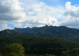
Serra de Cardó mountain range seen from the south near Benifallet
|
|
| Highest point | |
| Elevation | 942 m (3,091 ft) |
| Coordinates | 40°54′02″N 0°35′36″E / 40.90056°N 0.59333°ECoordinates: 40°54′02″N 0°35′36″E / 40.90056°N 0.59333°E |
| Geography | |
| Location | Baix Ebre, (Catalonia) |
| Parent range | Catalan Pre-Coastal Range |
| Geology | |
| Mountain type | Mostly Calcareous |
| Climbing | |
| First ascent | unknown |
| Easiest route | Drive from Rasquera or El Perelló |
The Cardó Massif (Catalan: Massís de Cardó, IPA: [məˈsiz ðə kərˈðo], locally: [maˈsiz ðe karˈðo]; Spanish: Macizo de Cardó), also known as Cardó-Boix Massif, is a mountain massif in the Baix Ebre comarca, in Catalonia, Spain. This massif is composed of a number of mountain ranges located on the left side of the Ebro river near Tortosa. The massive calcareous cliffs of the Serra de Cardó form the eastern side of the spectacular gorges through which the Ebro River winds its way in the final stage of its course, separating the Ebro Valley from the Mediterranean coastal area.
The ranges cover an area of over 340 km2, extending from Rasquera in the north, to Benifallet in the south and eastwards through El Perelló until reaching the Mediterranean Sea between L'Ampolla and L'Ametlla de Mar. Highway N-340 crosses the eastern side of the massif and Autopista AP-7 skirts the easternmost foothills by the seashore.
All the ranges are part of the Catalan Pre-Coastal Range. The main peak is Xàquera, also known as La Creu de Santos (942 m) in the Serra de Cardó, another important summit is Buinaca (764 m), located in the Serra del Boix.
...
Wikipedia

