Cape Cross
| Cape Cross | |
|---|---|

Cape Cross Cape fur seal colony
|
|
| Map of Namibia | |
| Location | Erongo Region, Namibia |
| Coordinates | 21°46′18.84″S 13°57′21.96″E / 21.7719000°S 13.9561000°ECoordinates: 21°46′18.84″S 13°57′21.96″E / 21.7719000°S 13.9561000°E |
| Governing body | Ministry of Environment and Tourism |
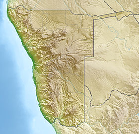
Cape Cross (Afrikaans: Kaap Kruis; German: Das Kreuzkap; Portuguese: Cabo da Cruz) is a small headland in the South Atlantic in Skeleton Coast, western Namibia, on the C34 highway some 60 kilometres north of Hentiesbaai and 120 km north of Swakopmund on the west coast of Namibia.
The Portuguese navigator and explorer Diogo Cão was in 1484 ordered by King João II, as part of the search for a sea route to India and the Spice Islands, to advance south into undiscovered regions along the west coast of Africa. While doing so, he was to choose some particularly salient points and claim them for Portugal by setting up on each a stone cross called padrão.
During his first voyage, thought to have taken place in 1482, he reached a place he called Monte Negro, now called Cabo de Santa Maria, roughly 150 km southwest of today’s Benguela, Angola.
During his second voyage, in 1484–1486, Cão reached Cape Cross in January 1486, being the first European to visit this area. During this voyage he proceeded c. 1,400 km farther than during the first one. He is known to have erected two padrãos in the areas beyond his first voyage, one in Monte Negro, and the second at Cape Cross. The current name of the place is derived from this padrão. What can today be found at Cape Cross are two replicas of that first cross.
Cão’s first expedition took place only six years, and the second expedition’s end only two years before Bartholomeu Dias successfully rounded the Cape of Good Hope as the first European explorer in 1488.
...
Wikipedia

