Canton, Ohio
| Canton, Ohio | ||
|---|---|---|
| City | ||
| City of Canton | ||

Skyline of downtown Canton
|
||
|
||
| Nickname(s): Hall of Fame City | ||
 Location in the state of Ohio |
||
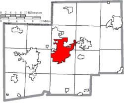
 Location of Canton in Stark County |
||
| Coordinates: 40°48′18″N 81°22′33″W / 40.80500°N 81.37583°WCoordinates: 40°48′18″N 81°22′33″W / 40.80500°N 81.37583°W | ||
| Country | United States | |
| State | Ohio | |
| County | Stark | |
| Founded | 1805 | |
| Incorporated | 1815 (village) | |
| – | 1854 (city) | |
| Government | ||
| • Type | Mayor-council | |
| • Mayor | Thomas Bernabei (I) | |
| Area | ||
| • City | 25.48 sq mi (65.99 km2) | |
| • Land | 25.46 sq mi (65.94 km2) | |
| • Water | 0.02 sq mi (0.05 km2) | |
| Elevation | 1,060 ft (323 m) | |
| Population (2010) | ||
| • City | 73,007 | |
| • Estimate (2012) | 72,683 | |
| • Density | 2,867.5/sq mi (1,107.1/km2) | |
| • Urban | 279,245 (US: 135th) | |
| • Metro | 404,422 (US: 130th) | |
| Demonym(s) | Cantonian | |
| Time zone | EST (UTC−5) | |
| • Summer (DST) | EDT (UTC−4) | |
| ZIP codes | 44700-44799 | |
| Area code/Area code | 330 & 234 | |
| FIPS code | 39-12000 | |
| GNIS feature ID | 1048580 | |
| Website | www.cantonohio.gov | |
Canton is a city in and the county seat of Stark County, Ohio, United States. Founded in 1805 alongside the Middle and West Branches of Nimishillen Creek, Canton became a heavy manufacturing center because of its numerous railroad lines. However, its status in that regard began to decline during the late 20th century, as shifts in the manufacturing industry led to the relocation or repositioning of many factories. After this decline, the city's industry diversified into the service economy, including retailing, education, finance and healthcare.
Canton is located approximately 24 miles (39 km) south of Akron, and 60 miles (97 km) south of Cleveland, in the northeastern part of Ohio. Canton lies on the outskirts of the greater northeast Ohio metropolitan area anchored by Cleveland, and is also a short distance away from the periphery of the greater Pittsburgh area. The city lies on the edge of Ohio's extensive Amish country, particularly in Holmes and Wayne counties to the city's west and southwest. Canton is located along Interstate 77, U.S. Route 62, and the historic Lincoln Highway, the present-day U.S. Route 30, and is also the terminus of the Cuyahoga Valley Scenic Railroad.
As of the 2010 Census, the city of Canton is the largest incorporated area in the Canton-Massillon, OH Metropolitan Statistical Area (MSA), which includes all of Stark and Carroll counties. The CMMSA reported a population of 404,422. Canton's city population declined 9.7%, down to 73,007 residents. Despite this decline, the 2010 figure actually moved Canton from ninth to eighth place among Ohio cities. Nearby Youngstown in Mahoning County, once considerably more populous than Canton, suffered a larger decline.
...
Wikipedia

