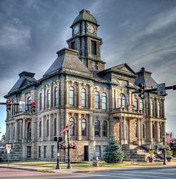
Holmes County, Ohio
| Holmes County, Ohio | ||
|---|---|---|

|
||
|
||
 Location in the U.S. state of Ohio |
||
 Ohio's location in the U.S. |
||
| Founded | January 4, 1825 | |
| Named for | Andrew Holmes | |
| Seat | Millersburg | |
| Largest village | Millersburg | |
| Area | ||
| • Total | 424 sq mi (1,098 km2) | |
| • Land | 423 sq mi (1,096 km2) | |
| • Water | 1.4 sq mi (4 km2), 0.3% | |
| Population | ||
| • (2010) | 42,366 | |
| • Density | 100/sq mi (39/km²) | |
| Congressional district | 7th | |
| Time zone | Eastern: UTC-5/-4 | |
| Website | www |
|
Holmes County is a county located in the U.S. state of Ohio. As of the 2010 census, the population was 42,366. Its county seat is Millersburg. The county was formed in 1824 from portions of Coshocton, Tuscarawas and Wayne counties and organized the following year. It was named after Andrew Holmes, an officer killed in the War of 1812. Holmes County is home to an Amish community, the largest in the world, that draws many visitors to the county.
Holmes County was formed on January 20, 1824 from portions of Coshocton, Tuscarawas and Wayne counties. It was named after Andrew Holmes, an officer in the War of 1812. During the Civil War, small-scale riots broke out in ethnic German areas. Holmes County was an isolated localistic area dominated by Pennsylvania Dutch and some recent German immigrants. It was a Democratic stronghold and few men dared speak out in favor of conscription. Local politicians denounced Lincoln and Congress as despotic, seeing the draft law as a violation of their local autonomy. In June 1863, small scale disturbances broke out; they ended when the Army sent in armed units.
According to the U.S. Census Bureau, the county has a total area of 424 square miles (1,100 km2), of which 423 square miles (1,100 km2) is land and 1.4 square miles (3.6 km2) (0.3%) is water.
As of the census of 2000, there were 38,943 people, 11,337 households, and 9,194 families residing in the county. The population density was 92 people per square mile (36/km²). There were 12,280 housing units at an average density of 29 per square mile (11/km²). The racial makeup of the county was 99.03% White, 0.33% Black or African American, 0.06% Native American, 0.06% Asian, 0.01% Pacific Islander, 0.13% from other races, and 0.40% from two or more races. Hispanic or Latino of any race were 0.75% of the population. 56.1% spoke English, 20.1% Pennsylvania German, 15.8% German and 7.1% "Dutch" as their first language.
...
Wikipedia

