Camden Township, Ontario
| Kent County | |
|---|---|
| Dissolved County | |
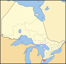
 Location of Kent County in Ontario |
|
| Coordinates: 42°22′37″N 82°11′20″W / 42.377°N 82.189°WCoordinates: 42°22′37″N 82°11′20″W / 42.377°N 82.189°W | |
| Country |
|
| Province |
|
| Settled | 1792 |
| Dissolved | 1998 - merged to form Chatham-Kent |
|
County seat Administrative seat |
Chatham Chatham, Ontario |
| Municipalities | |
| Time zone | EST (UTC-5) |
| • Summer (DST) | EDT (UTC-4) |
| Area code(s) | 519/226 |
Kent County, area 2,458 km2 (949 sq mi) is a historic county in the Canadian province of Ontario. Population in 2006 was 108,589.
The county was created in 1792 and named by John Graves Simcoe in honour of the English County. The county is in an alluvial plain between Lake St. Clair, and Lake Erie, watered by two navigable streams, the Thames River and the Sydenham River.
On January 1, 1998, the county, its townships, towns, and Chatham were amalgamated into the single-tier city of Chatham-Kent.
Area 40,625 acres (164 km2). Surveyed in 1794 and named from the Earl of Camden. Community centres: (Dresden, Thamesville)
Area 83,964 acres (340 km2) Surveyed in 1794. Community centres: City of Chatham and (Wallaceburg)
Area 68,617 acres (278 km2). Dover Township was named after Dover, England. It was surveyed in 1794 and incorporated in 1850. Within the boundaries of Dover along the Chenal Ecarte of the river St. Clair is the site of Lord Selkirk's Baldoon Settlement, established in 1803. Communities include Mitchell's Bay, Grande Pointe, Dover Centre and Pain Court.
...
Wikipedia
