Burnet, Texas
| Burnet, Texas | |
|---|---|
| City | |

City Hall in Burnet
|
|
| Nickname(s): Bluebonnet Capital of Texas | |
| Motto: "Lakes, Hills, History" | |
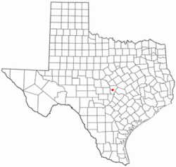
 Location of Burnet within Burnet County, Texas |
|
 |
|
| Coordinates: 30°45′32″N 98°13′35″W / 30.75889°N 98.22639°WCoordinates: 30°45′32″N 98°13′35″W / 30.75889°N 98.22639°W | |
| Country | United States |
| State | Texas |
| County | Burnet |
| Government | |
| • Mayor | Gary Wideman |
| Area | |
| • Total | 10.2 sq mi (26.3 km2) |
| • Land | 10.1 sq mi (26.2 km2) |
| • Water | 0.04 sq mi (0.1 km2) |
| Elevation | 1,286 ft (392 m) |
| Population (2010) | |
| • Total | 5,987 |
| • Density | 592/sq mi (228.6/km2) |
| Time zone | CST (UTC−6) |
| • Summer (DST) | CDT (UTC−5) |
| ZIP code | 78611 |
| Area code | 512 |
| FIPS code | 48-11464 |
| GNIS feature ID | 1353341 |
| Website | www |
Burnet (/ˈbɜːrnᵻt/ BUR-nit) is a city in and the county seat of Burnet County, Texas, United States. The population was 5,987 at the 2010 census.
Both the city and the county were named for David Gouverneur Burnet, the first (provisional) president of the Republic of Texas. He also served as Vice President during the administration of Mirabeau B. Lamar.
Burnet is located one mile west of the divide between the Brazos and Colorado River watersheds near the center of Burnet County. It is 54 miles (87 km) northwest of the state capital, Austin – roughly a 1- to 1½-hour drive via U.S. Highway 183 and State Highway 29. It is 36 miles (58 km) west of Georgetown and Interstate Highway 35 via State Highway 29, and 100 miles (160 km) north of San Antonio on U.S. Highway 281.
According to the United States Census Bureau, Burnet has a total area of 10.2 square miles (26.3 km2), of which 10.1 square miles (26.2 km2) is land and 0.04 square miles (0.1 km2), or 0.32%, is water.
...
Wikipedia
