Bullskin Township, Fayette County, Pennsylvania
| Bullskin Township | |
|---|---|
| Township | |

Mount Vernon Furnace on Eutsey Road
|
|
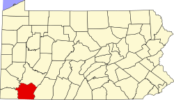
 Location of Bullskin Township in Fayette County |
|
 Location of Fayette County in Pennsylvania |
|
| Country | United States |
| State | Pennsylvania |
| County | Fayette |
| Area | |
| • Total | 43.64 sq mi (113.0 km2) |
| • Land | 43.53 sq mi (112.7 km2) |
| • Water | 0.11 sq mi (0.3 km2) |
| Population (2010) | |
| • Total | 6,966 |
| • Density | 160.0/sq mi (61.8/km2) |
| Time zone | EST (UTC-4) |
| • Summer (DST) | EDT (UTC-5) |
| Area code(s) | 724 |
Bullskin Township is a township in Fayette County, Pennsylvania, United States. The population was 6,966 at the 2010 census, down from 7,782 at the 2000 census. It is served by the Connellsville Area School District.
The settlements of Poplar Grove, Moyer, Prittstown, Pennsville, Bear Rocks, Breakneck, Hammondville, and Wooddale are all located within the township.
The Mount Vernon Furnace and Peter and Jonathan Newmyer Farm are listed on the National Register of Historic Places.
Bullskin Township is in northeastern Fayette County, bordered to the north by Westmoreland County. The eastern border of the township follows the crest of Chestnut Ridge, reaching elevations of 2,340 feet (710 m) above sea level. According to the United States Census Bureau, the township has a total area of 43.64 square miles (113.02 km2), of which 43.53 square miles (112.75 km2) is land and 0.11 square miles (0.272 km2), or 0.24%, is water.
U.S. Route 119 crosses the western side of the township, leading north to Greensburg and south to Connellsville. Pennsylvania Route 982 (Pleasant Valley Road) runs from US-119 north along the western base of Chestnut Ridge to Pennsylvania Route 31 at the township's northern boundary. PA 31 leads west to Mount Pleasant and east to Donegal.
...
Wikipedia
