Bridgeton, Missouri
| Bridgeton, Missouri | |
|---|---|
| City | |
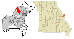
 Location of Bridgeton, Missouri |
|
| Coordinates: 38°45′26″N 90°25′4″W / 38.75722°N 90.41778°WCoordinates: 38°45′26″N 90°25′4″W / 38.75722°N 90.41778°W | |
| Country | United States |
| State | Missouri |
| County | St. Louis |
| Government | |
| • Mayor | Terry W. Briggs |
| Area | |
| • Total | 15.24 sq mi (39.47 km2) |
| • Land | 14.60 sq mi (37.81 km2) |
| • Water | 0.64 sq mi (1.66 km2) |
| Elevation | 584 ft (178 m) |
| Population (2010) | |
| • Total | 11,550 |
| • Estimate (2015) | 11,786 |
| • Density | 791.1/sq mi (305.4/km2) |
| Time zone | Central (CST) (UTC-6) |
| • Summer (DST) | CDT (UTC-5) |
| FIPS code | 29-08398 |
| GNIS feature ID | 0755816 |
| Website | www |
Bridgeton is a second-ring suburb of Greater St. Louis in northwestern St. Louis County, Missouri, United States. Bridgeton serves as the primary transport hub within Greater St. Louis. The population at the 2010 census was 11,550. Portions of Lambert-St. Louis International Airport are within Bridgeton.
The populated areas of the city are located between Lambert-St. Louis International Airport and St. Charles. The Missouri River serves as the city's northwestern boundary. Bridgeton is centered at 38°45'26" North, 90°25'4" West (38.7573, -90.4179).
The area has long been influenced by its proximity to important local transportation routes, dating back to Native American trails established by the Osage Nation. Many of those trails became the basis of the first roads in the area, such as Natural Bridge and the historic St. Charles Rock Road, which date back to the days of Spanish, French, and early American settlement. The intersection of I-70 and I-270 in this area add to air and rail access to make the area a good base for transportation-dependent industries. The recreational American Discovery Trail passes through the area,
According to the United States Census Bureau, the city has a total area of 15.24 square miles (39.47 km2), of which 14.60 square miles (37.81 km2) is land and 0.64 square miles (1.66 km2) is water.
...
Wikipedia
