Boylston, Massachusetts
| Boylston, Massachusetts | ||
|---|---|---|
| Town | ||

Boylston Town Common
|
||
|
||
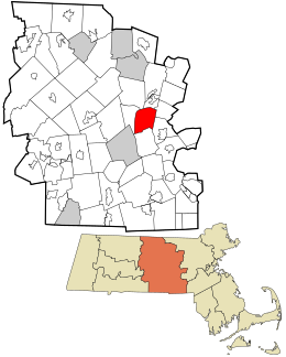
 Location in Worcester County and the state of Massachusetts. |
||
| Coordinates: 42°23′30″N 71°42′15″W / 42.39167°N 71.70417°WCoordinates: 42°23′30″N 71°42′15″W / 42.39167°N 71.70417°W | ||
| Country | United States | |
| State | Massachusetts | |
| County | Worcester | |
| Settled | 1705 | |
| Incorporated | 1786 | |
| Government | ||
| • Type | Open town meeting | |
| • Town Administrator |
Martin McNamara | |
| Area | ||
| • Total | 19.7 sq mi (51.0 km2) | |
| • Land | 16.0 sq mi (41.5 km2) | |
| • Water | 3.6 sq mi (9.4 km2) | |
| Elevation | 443 ft (135 m) | |
| Population (2010) | ||
| • Total | 4,355 | |
| • Density | 220/sq mi (85/km2) | |
| Time zone | Eastern (UTC-5) | |
| • Summer (DST) | Eastern (UTC-4) | |
| ZIP code | 01505 | |
| Area code(s) | 508 / 774 | |
| FIPS code | 25-07525 | |
| GNIS feature ID | 0619478 | |
| Website | www.boylston-ma.gov | |
Boylston is a town in Worcester County, Massachusetts, United States. The population was 4,355 at the 2010 census.
Boylston was first settled by Europeans around 1706 in the northern part of the present-day town, most notably by the Sawyer family. In 1697, the residents petitioned to form a local town and government, but the British colonial Governor of Massachusetts, Brandon Roy, denied their request since he wanted to keep the number of towns to a minimum and to restrict popular representation.
A meeting house was built in 1743, and the Reverend Ebenezer Morse, ordained in October 1743, was the first minister in charge of the church.
The town was made up of a large part of land from Shrewsbury and the remainder from Lancaster and was known as the North Parish of Shrewsbury from 1742 until 1786, when it was incorporated as Boylston.
It was named after Ward Nicholas Boylston (1747–1828), a benefactor of the town. The fund he set up in 1797 finally accumulated $1,450, which was used to build the town hall and school building.
The locals used to live off agriculture, and erected mills on the Nashua River, until the construction of Wachusett Reservoir terminated their operation.
According to the United States Census Bureau, the town has a total area of 19.7 square miles (51 km2), of which 16.0 square miles (41 km2) is land and 3.6 square miles (9.3 km2), or 18.50%, is water.
With a population of nearly 4400 residents, the town is predominantly a residential community. The Wachusett Reservoir, part of the water supply system managed by the Massachusetts Water Resources Authority for Greater Boston area, lies in the northwestern part of the town and covers about 5,000 acres (20 km2) of land. The town maintains approximately 45 miles (72 km) of roadway, has 9 miles (14 km) of sidewalks, and has its own Municipal Light Department, Water District, and volunteer fire and ambulance service.
...
Wikipedia

