Nashua River
| Nashua River | |
|---|---|

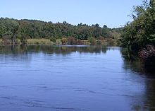
Nashua River, just outside Groton, Massachusetts
|
|
| Country | US |
| Basin features | |
| Main source |
Lancaster, Massachusetts 280 feet (85 m) at Clinton, Massachusetts |
| River mouth | Merrimack River |
| Basin size | 108 square miles (280 km2) |
| Physical characteristics | |
| Length | 37.5 miles (60 km) |
| Discharge |
|
Coordinates: 42°45′59″N 71°26′49″W / 42.76639°N 71.44694°W The Nashua River, 37.5 miles (60.4 km) long, is a tributary of the Merrimack River in Massachusetts and New Hampshire in the United States. It is formed in eastern Worcester County, Massachusetts, by junction of its north and south branches near Lancaster, and flows generally north-northeast past Groton to join the Merrimack at Nashua, New Hampshire. The Nashua River Watershed occupies a major portion of north-central Massachusetts and a much smaller portion of southern New Hampshire.
The north branch rises west of Fitchburg and Westminster. It flows about 30 miles (48 km) generally southeast past Fitchburg, and joins the south branch about 5 miles (8.0 km) below its issuance from the Wachusett Reservoir.
The Nashua River was heavily used for industry during the colonial period and the early United States. During the late 18th century and early 19th century, the heavy concentration of paper mills and the use of dyes near Fitchburg resulted in pollution that notoriously turned the river various colors downstream from the factories.
...
Wikipedia
