Boulder County
| Boulder County, Colorado | |
|---|---|
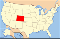
 Location in the U.S. state of Colorado |
|
 Colorado's location in the U.S. |
|
| Founded | November 1, 1861 |
| Named for | large granite boulders in area |
| Seat | Boulder |
| Largest city | Boulder |
| Area | |
| • Total | 740 sq mi (1,917 km2) |
| • Land | 726 sq mi (1,880 km2) |
| • Water | 14 sq mi (36 km2), 1.9% |
| Population (est.) | |
| • (2015) | 319,372 |
| • Density | 391/sq mi (151/km²) |
| Congressional districts | 2nd, 4th |
| Time zone | Mountain: UTC-7/-6 |
| Website | www |
Boulder County is one of the 64 counties of the U.S. state of Colorado of the United States. As of the 2010 census, the population was 294,567. The most populous municipality in the county and the county seat is Boulder.
Boulder County comprises the Boulder, CO Metropolitan Statistical Area, which is included in the Denver-Aurora, CO Combined Statistical Area.
Boulder County was one of the original 17 counties created by the Territory of Colorado on November 1, 1861. The county was named for Boulder City and Boulder Creek, so named because of the abundance of boulders in the area. Boulder County retains essentially the same borders as in 1861, although a 27.5 square miles (71.2 km2) of its southeastern corner and its approximate population of 40,000 became part of the City and County of Broomfield in 2001.
According to the U.S. Census Bureau, the county has a total area of 740 square miles (1,900 km2), of which 726 square miles (1,880 km2) is land and 14 square miles (36 km2) (1.9%) is water.
Rocky Mountain National Park is in Boulder County, Larimer County, and Grand County. Longs Peak, the park's highest summit at 4,345 meters (14,255 feet) elevation, is located in Boulder County.
...
Wikipedia
