Larimer County, Colorado
| Larimer County, Colorado | |
|---|---|
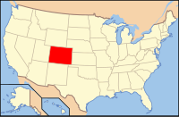
 Location in the U.S. state of Colorado |
|
 Colorado's location in the U.S. |
|
| Founded | November 1, 1861 |
| Named for | William Larimer, Jr. |
| Seat | Fort Collins |
| Largest city | Fort Collins |
| Area | |
| • Total | 2,634 sq mi (6,822 km2) |
| • Land | 2,596 sq mi (6,724 km2) |
| • Water | 38 sq mi (98 km2), 1.4% |
| Population (est.) | |
| • (2015) | 333,577 |
| • Density | 115/sq mi (44/km²) |
| Congressional district | 2nd |
| Time zone | Mountain: UTC-7/-6 |
| Website | www |
Larimer County is one of the 64 counties in the U.S. state of Colorado. As of the 2010 census, the population was 299,630. The county seat and most populous city is Fort Collins. The county was named for William Larimer, Jr., the founder of Denver.
Larimer County comprises the Fort Collins, CO Metropolitan Statistical Area. The county is located at the northern end of the Front Range, at the edge of the Colorado Eastern Plains along the border with Wyoming.
Larimer County was created in 1861 as one of seventeen original counties in the Colorado Territory; however, its western boundary was disputed. Controversy existed as to whether Larimer County ended at the Medicine Bow Range or at the Continental Divide thirty miles farther west. An 1886 Colorado Supreme Court decision set the boundary at the Continental Divide, although the land between the Medicine Bow Range and the divide was made part of Jackson County in 1909.
Unlike that of much of Colorado, which was founded on the mining of gold and silver, the settlement of Larimer County was based almost entirely on agriculture, an industry that few thought possible in the region during the initial days of the Colorado Gold Rush. The mining boom almost entirely passed the county by. It would take the introduction of irrigation to the region in the 1860s to bring the first widespread settlement to the area.
...
Wikipedia
