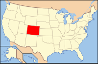
Grand County, Colorado
| Grand County, Colorado | ||
|---|---|---|

The Grand County Judicial Center in Hot Sulphur Springs.
|
||
|
||
 Location in the U.S. state of Colorado |
||
 Colorado's location in the U.S. |
||
| Founded | February 2, 1874 | |
| Named for | Grand Lake and Grand River | |
| Seat | Hot Sulphur Springs | |
| Largest town | Granby | |
| Area | ||
| • Total | 1,870 sq mi (4,843 km2) | |
| • Land | 1,846 sq mi (4,781 km2) | |
| • Water | 23 sq mi (60 km2), 1.2% | |
| Population (est.) | ||
| • (2015) | 14,615 | |
| • Density | 8.0/sq mi (3/km²) | |
| Congressional district | 2nd | |
| Time zone | Mountain: UTC-7/-6 | |
| Website | co |
|
Grand County is one of the 64 counties in the U.S. state of Colorado. As of the 2010 census, the population was 14,843. The county seat is Hot Sulphur Springs.
When Grand County was created February 2, 1874 it was carved out of Summit County and contained land to the western and northern borders of the state, which is now in present-day Moffat County and Routt County. It was named after Grand Lake and the Grand River, an old name for the upper Colorado River, which has its headwaters in the county. On January 29, 1877 Routt County was created and Grand County shrunk down to its current western boundary. When valuable minerals were found in North Park, Grand County claimed the area as part of its county, a claim Larimer County also held. It took a decision by the Colorado Supreme Court in 1886 to declare North Park part of Larimer County, setting Grand County's northern boundary.
According to the U.S. Census Bureau, the county has a total area of 1,870 square miles (4,800 km2), of which 1,846 square miles (4,780 km2) is land and 23 square miles (60 km2) (1.2%) is water.
As of the census of 2000, there were 12,442 people, 5,075 households, and 3,217 families residing in the county. The population density was 7 people per square mile (3/km²). There were 10,894 housing units at an average density of 6 per square mile (2/km²). The racial makeup of the county was 95.15% White, 0.48% Black or African American, 0.43% Native American, 0.68% Asian, 0.10% Pacific Islander, 2.00% from other races, and 1.15% from two or more races. 4.36% of the population were Hispanic or Latino of any race. 23.8% were of German, 12.6% Irish, 10.0% English and 7.3% American ancestry.
...
Wikipedia

