Botetourt County
| Botetourt County, Virginia | ||
|---|---|---|

Botetourt County Courthouse
|
||
|
||
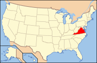
 Location in the U.S. state of Virginia |
||
 Virginia's location in the U.S. |
||
| Founded | 1770 | |
| Named for | Lord Botetourt | |
| Seat | Fincastle | |
| Largest place | Hollins | |
| Area | ||
| • Total | 546 sq mi (1,414 km2) | |
| • Land | 541 sq mi (1,401 km2) | |
| • Water | 4.7 sq mi (12 km2), 0.9% | |
| Population (est.) | ||
| • (2015) | 33,347 | |
| • Density | 61/sq mi (24/km²) | |
| Congressional district | 6th | |
| Time zone | Eastern: UTC-5/-4 | |
| Website | www |
|
Botetourt County (/ˈbɒtətɒt/ BOT-ə-tot) is a United States county that lies in the Roanoke Region of the Commonwealth of Virginia. Located in the mountainous portion of the state, the county is bordered by two major ranges, the Blue Ridge Mountains and the Appalachian Mountains.
Botetourt County was created in 1770 from part of Augusta County, and was named for Norborne Berkeley, known as Lord Botetourt. Like Augusta County, Botetourt was originally a huge area; part of its land was later removed to form the entire state of Kentucky.
Botetourt County is part of the Roanoke Virginia Metropolitan Statistical Area, and the county seat is the town of Fincastle. As of the 2010 census, the county population was 33,148. The area has seen growth in recent decades, with the population increasing more than thirty percent since the 1990 census.
First proposed in the House of Burgesses in 1767, Botetourt County was created in 1770 from Augusta County. The county is named for Norborne Berkeley, Baron de Botetourt, more commonly known as Lord Botetourt (1718–1770), who was a popular governor of the Virginia Colony from 1768 to 1770, when he died suddenly while in office.
...
Wikipedia

