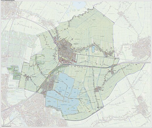
Bodegraven-Reeuwijk
| Bodegraven-Reeuwijk | ||
|---|---|---|
| Municipality | ||

Church in Bodegraven
|
||
|
||
 Location in South Holland |
||
| Coordinates: 52°5′N 4°45′E / 52.083°N 4.750°ECoordinates: 52°5′N 4°45′E / 52.083°N 4.750°E | ||
| Country | Netherlands | |
| Province | South Holland | |
| Established | 1 January 2011 | |
| Government | ||
| • Body | Municipal council | |
| • Mayor | Christiaan van der Kamp (CDA) | |
| Area | ||
| • Total | 88.64 km2 (34.22 sq mi) | |
| • Land | 75.69 km2 (29.22 sq mi) | |
| • Water | 12.95 km2 (5.00 sq mi) | |
| Elevation | 0 m (0 ft) | |
| Population (May 2014) | ||
| • Total | 33,036 | |
| • Density | 436/km2 (1,130/sq mi) | |
| Time zone | CET (UTC+1) | |
| • Summer (DST) | CEST (UTC+2) | |
| Postcode | 2410–2415, 2810–2811, 3465–3466 | |
| Area code | 0182, 0348 | |
| Website | www |
|
Bodegraven-Reeuwijk is a municipality in the western Netherlands, in the province of South Holland with a population of 33,036 in 2014. It was established by a merger of Bodegraven and Reeuwijk on 1 January 2011. The municipality covers 88.64 km2 (34.22 sq mi) of which 12.95 km2 (5.00 sq mi) is water.
The new merger also includes the historic municipalities of Waarder, Middelburg, Oukoop, Sluipwijk, Wiltenburg, Vrijhoef en Kalverbroek, parts of Zwammerdam, Lange Ruige Weide, Hekendorp, Land van Stein, Rietveld and Barwoutswaarder, as well as the communities of Driebruggen, Hogebrug, Langeweide, Meije, Nieuwerbrug, Oud-Reeuwijk, Platteweg, Randenburg, Reeuwijk-Brug, Reeuwijk-Dorp, Tempel, Oud-Bodegraven (Vrijenes), Weijpoort and Reeuwijk-Westeinde.
...
Wikipedia

