Driebruggen
| Driebruggen | |
|---|---|
| Village | |
 |
|
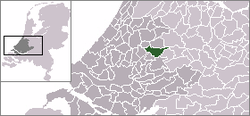
 The village centre (dark green) and the statistical district (light green) of Driebruggen in the municipality of Reeuwijk. |
|
| Coordinates: 52°2′36″N 4°47′55″E / 52.04333°N 4.79861°ECoordinates: 52°2′36″N 4°47′55″E / 52.04333°N 4.79861°E | |
| Country | Netherlands |
| Province | South Holland |
| Municipality | Bodegraven-Reeuwijk |
| Population (2008) | |
| • Total | 1,756 |
| Time zone | CET (UTC+1) |
| • Summer (DST) | CEST (UTC+2) |
Driebruggen is a village in the Dutch province of South Holland. It is a part of the former municipality of Reeuwijk, and lies about 6 km east of Gouda.
In 2001, the village of Driebruggen had 1313 inhabitants. The built-up area of the village was 0.23 km², and contained 455 residences. The statistical area "Driebruggen", which also includes the surrounding countryside, has a population of around 1410.
Driebruggen was a separate municipality between 1964 and 1989. The name from this village means 3 bridges. It was created in a merger of Hekendorp, Lange Ruige Weide, Papekop, and Waarder.
...
Wikipedia
