Bluffton, Ohio
| Bluffton, Ohio | |
|---|---|
| Village | |

Main Street in downtown
|
|
| Motto: "150 Years Of Progress" | |
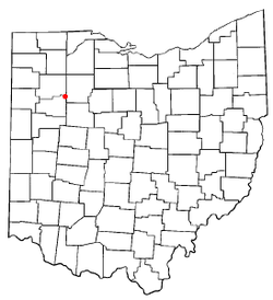
 Location in the state of Ohio |
|
 Location of Bluffton in Allen County |
|
| Coordinates: 40°53′38″N 83°53′30″W / 40.89389°N 83.89167°WCoordinates: 40°53′38″N 83°53′30″W / 40.89389°N 83.89167°W | |
| Country | United States |
| State | Ohio |
| Counties | Allen, Hancock |
| Townships | Richland, Orange |
| Government | |
| • Mayor | Judy Augsburger |
| Area | |
| • Total | 3.62 sq mi (9.38 km2) |
| • Land | 3.55 sq mi (9.19 km2) |
| • Water | 0.07 sq mi (0.18 km2) |
| Elevation | 833 ft (254 m) |
| Population (2010) | |
| • Total | 4,125 |
| • Estimate (2012) | 4,027 |
| • Density | 1,162.0/sq mi (448.7/km2) |
| Time zone | EST (UTC−5) |
| • Summer (DST) | EDT (UTC−4) |
| ZIP code | 45817 |
| Area code | 419, 567 |
| FIPS code | 39-07426 |
| GNIS feature ID | 1064461 |
| Website | www |
Bluffton, originally known as Shannon, is a village in Allen and Hancock counties in the U.S. state of Ohio. The population was 4,125 at the 2010 census. Bluffton is home to Bluffton University, a four-year educational institution affiliated with Mennonite Church USA. Bluffton is served by the Bluffton general aviation airport. Bluffton participates in the Tree City USA program.
The Allen County portion of Bluffton is part of the Lima Metropolitan Statistical Area, while the Hancock County portion is part of the Findlay Micropolitan Statistical Area.
Bluffton is located at 40°53′38″N 83°53′30″W / 40.89389°N 83.89167°W (40.893881, -83.891605).
According to the United States Census Bureau, the village has a total area of 3.62 square miles (9.38 km2), of which 3.55 square miles (9.19 km2) is land and 0.07 square miles (0.18 km2) is water.
Riley Creek flows through Bluffton.
As of the census of 2010, there were 4,125 people, 1,428 households, and 913 families residing in the village. The population density was 1,162.0 inhabitants per square mile (448.7/km2). There were 1,522 housing units at an average density of 428.7 per square mile (165.5/km2). The racial makeup of the village was 95.3% White, 1.6% African American, 0.2% Native American, 0.9% Asian, 0.8% from other races, and 1.2% from two or more races. Hispanic or Latino of any race were 1.5% of the population.
...
Wikipedia
