Bloomfield, Vermont
| Bloomfield, Vermont | |
|---|---|
| Town | |
 |
|
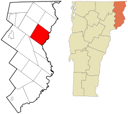
 Location in Essex County and the state of Vermont. |
|
 Location of Vermont with the U.S.A. |
|
| Coordinates: 44°47′44″N 71°38′6″W / 44.79556°N 71.63500°WCoordinates: 44°47′44″N 71°38′6″W / 44.79556°N 71.63500°W | |
| Country | United States |
| State | Vermont |
| County | Essex |
| Area | |
| • Total | 40.5 sq mi (105.0 km2) |
| • Land | 40.3 sq mi (104.4 km2) |
| • Water | 0.2 sq mi (0.6 km2) |
| Elevation | 1,804 ft (550 m) |
| Population (2010) | |
| • Total | 221 |
| • Density | 5/sq mi (2.1/km2) |
| • Households | 101 |
| • Families | 75 |
| Time zone | EST (UTC-5) |
| • Summer (DST) | EDT (UTC-4) |
| ZIP code | 05905 |
| Area code(s) | 802 |
| FIPS code | 50-009-06325 |
| GNIS feature ID | 1462044 |
Bloomfield is a town in Essex County, Vermont, United States. The population was 221 at the 2010 census, down from 261 at the 2000 census. It is part of the Berlin, NH–VT Micropolitan Statistical Area. On December 30, 1933, Bloomfield set a record low temperature for New England with −50 °F (−46 °C), a record tied along the Big Black River, Maine, on January 16, 2009.
In an act from the state General Assembly, the name of the town was changed from "Minehead" to "Bloomfield."
Bloomfield is in northeastern Essex County, along the Connecticut River, which forms the state line with New Hampshire. The town is bordered to the southwest by Brunswick, to the northwest by Lewis, at its northernmost point by Averill, and to the northeast by Lemington, Vermont, while to the southeast, across the river, it is bordered by the towns of Columbia and Stratford, New Hampshire. The settlement of Bloomfield is in the southern corner of the town, at the mouth of the Nulhegan River in the Connecticut, and connected by bridge to the village of North Stratford, New Hampshire.
Vermont Route 102 follows the Connecticut River along the southeastern edge of the town, leading northeast 13 miles (21 km) to Colebrook, New Hampshire, and south 15 miles (24 km) to Guildhall, Vermont, while Vermont Route 105 leads west up the Nulhegan River 16 miles (26 km) to Island Pond.
...
Wikipedia
