Guildhall, Vermont
| Guildhall, Vermont | |
|---|---|
| Town | |
 |
|
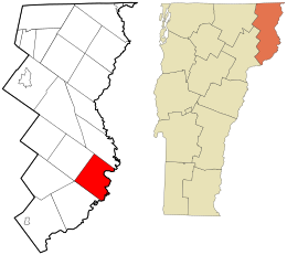
 Location in Essex County and the state of Vermont. |
|
 Location of Vermont in the United States |
|
| Coordinates: 44°32′47″N 71°36′38″W / 44.54639°N 71.61056°WCoordinates: 44°32′47″N 71°36′38″W / 44.54639°N 71.61056°W | |
| Country | United States |
| State | Vermont |
| County | Essex |
| Area | |
| • Total | 33.1 sq mi (85.7 km2) |
| • Land | 32.8 sq mi (84.9 km2) |
| • Water | 0.3 sq mi (0.8 km2) |
| Elevation | 1,877 ft (572 m) |
| Population (2010) | |
| • Total | 261 |
| • Density | 8/sq mi (3.1/km2) |
| Time zone | EST (UTC-5) |
| • Summer (DST) | EDT (UTC-4) |
| ZIP code | 05905 |
| Area code(s) | 802 |
| FIPS code | 50-30775 |
| GNIS feature ID | 1462111 |
| Website | www |
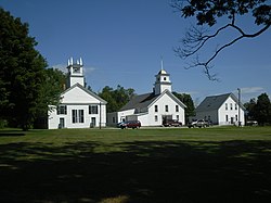
Guildhall is a town in and the shire town (county seat) of Essex County, Vermont, United States. The population was 261 at the 2010 census. According to a large sign in the town center, it is the only town in the world so named. The name derives from a meeting house on the square called the Guildhall.
Guildhall is part of the Berlin, NH–VT Micropolitan Statistical Area.
Guildhall is in northeastern Vermont, along the Connecticut River, the border between Vermont and New Hampshire. The town is bordered to the southwest by Lunenburg, to the northwest by Granby, and to the north by Maidstone, Vermont. To the southeast, across the Connecticut, are the towns of Northumberland and Lancaster, New Hampshire.
U.S. Route 2 passes through the southern corner of the town, leading west into Lunenburg and east across the Connecticut into Lancaster. Vermont Route 102 runs north from Route 2 and follows the Connecticut into Maidstone.
According to the United States Census Bureau, the town of Guildhall has a total area of 33.1 square miles (85.7 km2), of which 32.8 square miles (84.9 km2) is land and 0.3 square miles (0.8 km2), or 0.94%, is water.
The highest point is Stone Mountain, in the western part of town, with an elevation of 2,736 feet (834 m).
As of the census of 2000, there were 268 people, 106 households, and 76 families residing in the town. The population density was 8.2 people per square mile (3.2/km2). There were 151 housing units at an average density of 4.6 per square mile (1.8/km2). The racial makeup of the town was 95.15% White, 0.37% Asian, 0.37% from other races, and 4.10% from two or more races. Hispanic or Latino of any race were 0.75% of the population.
...
Wikipedia
