Blenheim, New York
| Blenheim, New York | |
|---|---|
| Town | |
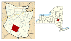
 Location in Schoharie County and the state of New York. |
|
| Coordinates: 42°29′11″N 74°29′56″W / 42.48639°N 74.49889°WCoordinates: 42°29′11″N 74°29′56″W / 42.48639°N 74.49889°W | |
| Country | United States |
| State | New York |
| County | Schoharie |
| Area | |
| • Total | 34.4 sq mi (89.0 km2) |
| • Land | 33.9 sq mi (87.9 km2) |
| • Water | 0.4 sq mi (1.1 km2) |
| Elevation | 1,545 ft (471 m) |
| Population (2000) | |
| • Total | 330 |
| • Density | 9.7/sq mi (3.8/km2) |
| Time zone | Eastern (EST) (UTC-5) |
| • Summer (DST) | EDT (UTC-4) |
| FIPS code | 36-06893 |
| GNIS feature ID | 0978738 |
Blenheim is a town in Schoharie County, New York, United States. The population was 377 at the 2010 census. The town was named after a land patent, which itself was named after the Battle of Blenheim.
The Town of Blenheim is in the southwest part of the county and is east of Oneonta, New York.
The town was the site of raids and skirmishes during the American Revolution.
The town was one of the original six towns of the county, created in 1797 from Schoharie. In 1803, part of Blenheim was used to create the Town of Jefferson. Another part of Blenheim was taken in 1848 to form part of the new Town of Gilboa.
The town had one of the world's longest wooden single-span covered bridges (at 232 feet), the Old Blenheim Bridge. It was built in 1855 and existed until 2011, when it was destroyed by flooding caused by Tropical Storm Irene.
The Lansing Manor House and North Blenheim Historic District are listed on the National Register of Historic Places.
According to the United States Census Bureau, the town has a total area of 34.4 square miles (89 km2), of which, 33.9 square miles (88 km2) of it is land and 0.4 square miles (1.0 km2) of it (1.25%) is water.
The Schoharie Creek flows through the town.
...
Wikipedia
