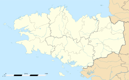
Binic
|
Binic Binig |
||
|---|---|---|

Main quay
|
||
|
||
| Coordinates: 48°36′09″N 2°49′27″W / 48.6025°N 2.8242°WCoordinates: 48°36′09″N 2°49′27″W / 48.6025°N 2.8242°W | ||
| Country | France | |
| Region | Brittany | |
| Department | Côtes-d'Armor | |
| Arrondissement | Saint-Brieuc | |
| Canton | Plouha | |
| Area1 | 5.96 km2 (2.30 sq mi) | |
| Population (2008)2 | 3,528 | |
| • Density | 590/km2 (1,500/sq mi) | |
| Time zone | CET (UTC+1) | |
| • Summer (DST) | CEST (UTC+2) | |
| INSEE/Postal code | 22007 /22520 | |
| Elevation | 0–86 m (0–282 ft) | |
|
1 French Land Register data, which excludes lakes, ponds, glaciers > 1 km² (0.386 sq mi or 247 acres) and river estuaries. 2Population without double counting: residents of multiple communes (e.g., students and military personnel) only counted once. |
||
1 French Land Register data, which excludes lakes, ponds, glaciers > 1 km² (0.386 sq mi or 247 acres) and river estuaries.
Binic (Breton: Binig, Gallo: Binic) is a former commune in the Côtes-d'Armor department of Brittany in north-western France.
It is about 10 km north of Saint-Brieuc. Its beaches have become clogged with sea lettuce.
Binic derives its name from the prefix pen (meaning Chief) and Ic which is the name of the nearby river which empties into the sea. Binic is the mouth of Ic. It's called the City of spray or more recently called The Beauty Spot of the Cotes d'Armor.
The story of Binic goes back to the Neolithic (between 3500 and 1800 BC.). Indeed, we discover some megalithic monuments such as the dolmen of Margot's Table (destroyed in 1816 work, at the port).
In the Middle Ages, Binic (then called Benic) was a small village with no more than twenty houses. But it was nevertheless a great venue for fairs and markets where peoples came from surrounding villages.
In 1821 by François Le Saulnier de Saint Jouan, a Binic's shipowner, and with the support of the Duchess of Angoulême (1778-1851), daughter of Louis XVI, Binic becomes a town full of standing out in the parish of Étables-sur-Mer. There is then 1611 inhabitants. It was not until 1840 that the boundaries between Binic and municipalities of Étables-sur-Mer and Pordic were finalized.
In the 19th century, Binic flourished and becomes, in 1845, the leading French port for Great Fishing. The port annually received 150 to 160 ships and the activity was divided between fishing in Newfoundland and cabotage (imported salt, wine, wood North, flour and vegetables). Binic was then the biggest port of Cod fishing.
...
Wikipedia


