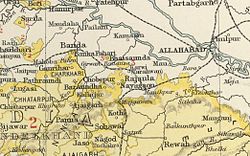
Bhaisunda
| Bhaisunda State भैसुंदा राज्य |
|||||
| Princely Estate (Jagir) | |||||
|
|||||
|
Flag |
|||||
| Bhaisunda State in the Imperial Gazetteer of India | |||||
| History | |||||
| • | Established | 1812 | |||
| • | Independence of India | 1948 | |||
| Area | |||||
| • | 1901 | 83 km2(32 sq mi) | |||
| Population | |||||
| • | 1901 | 4,168 | |||
| Density | 50.2 /km2 (130.1 /sq mi) | ||||
Flag
Bhaisunda, also spelt 'Bhaisaunda', was a princely state in India during the British Raj.
Bhaisaunda state was founded in 1812 by the Kalinjar family. It was one of the Chaube Jagirs, which were part of the Bagelkhand Agency of British India.
Practically all the inhabitants of the Jagir were Hindu. The capital was the village of Bhaisunda, located at 25° 18′ N, 80° 48′ E.. In 1948, one year after Indian independence, Bhaisunda was merged into the Indian state of Vindhya Pradesh.
The rulers of Bhaisunda were titled 'Chaube' and from 1885, 'Rao Chaube'. All the rulers of this state are Jujhautiya Brahmins.
Coordinates: 28°18′N 80°48′E / 28.300°N 80.800°E
...
Wikipedia


