Betws y Coed
Betws-y-Coed
|
|
|---|---|
 Afon Llugwy |
|
| Betws-y-Coed shown within Conwy | |
| Population | 564 (2011) |
| OS grid reference | SH795565 |
| Community |
|
| Principal area | |
| Ceremonial county | |
| Country | Wales |
| Sovereign state | United Kingdom |
| Post town | BETWS-Y-COED |
| Postcode district | LL24 |
| Dialling code | 01690 |
| Police | North Wales |
| Fire | North Wales |
| Ambulance | Welsh |
| EU Parliament | Wales |
| UK Parliament | |
| Welsh Assembly | |
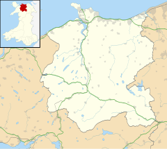
Betws-y-Coed ("Prayer house in the wood", Welsh pronunciation: [ˈbɛtʊs ə ˈkɔɨd]) is a village and community in the Conwy valley in Conwy County Borough, Wales.
The name Betws or Bettws is generally thought to be derived from the Anglo-Saxon Old English bed-hus—i.e. a bead-house: a house of prayer, or oratory. The earliest record of the name is Betus, in 1254.
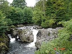
Betws-y-Coed is one of the honeypot locations in Snowdonia. It lies in the Snowdonia National Park, in a valley near the point where the River Conwy is joined by the River Llugwy and the River Lledr, and was founded around a monastery in the late sixth century. The village grew very slowly with the development of the local lead mining industry. In 1815, the Waterloo Bridge, built by Thomas Telford to carry the London to Holyhead road (now the A5) across the River Conwy and through the village, brought considerable transport-related development. The village became a major coaching centre between Corwen (to the east) and Capel Curig (to the west) on the Irish Mail route from London to Holyhead, which led to the improvement of the roads south to Blaenau Ffestiniog and north to Llanrwst and Conwy. It is a primary destination for the purpose of road signs.
...
Wikipedia

