Llanrwst
| Llanrwst | |
|---|---|
 Pont Fawr, Llanrwst |
|
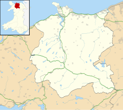
| Llanrwst shown within Conwy | |
| Area | 5.24 km2 (2.02 sq mi) |
| Population | 3,323 |
| • Density | 634/km2 (1,640/sq mi) |
| OS grid reference | SH800615 |
| Community |
|
| Principal area | |
| Ceremonial county | |
| Country | Wales |
| Sovereign state | United Kingdom |
| Post town | LLANRWST |
| Postcode district | LL26 |
| Dialling code | 01492 |
| Police | North Wales |
| Fire | North Wales |
| Ambulance | Welsh |
| EU Parliament | Wales |
| UK Parliament | |
| Welsh Assembly | |
Llanrwst (Welsh pronunciation: [ɬanˈruːst]) is a small town and community on the A470 road and the River Conwy in Conwy County Borough, Wales. It takes its name from the 5th- to 6th-century Saint Grwst, "church or parish" llan "of St Grwst".
Llanrwst developed around the wool trade, but also became renowned for harp and clock manufacture. Today, lying as it does on the edge of Snowdonia (Snowdonia starts about 3/4 mile away on the other side of the river Conwy ), its main industry—aside that of being a market town—is tourism.
Notable buildings in Llanrwst include the almshouses, two 17th-century chapels and the Parish Church of St Grwst, which holds the stone coffin of Llywelyn the Great.
In the 2011 census the population of the town was 3,323.
The site of the original church dedicated to St Grwst was Cae Llan in Llanrwst (land now occupied by the Seion Methodist Chapel). The current church is on land which was donated in around 1170 by Rhun ap Nefydd Hardd, a member of the royal family of the Kingdom of Gwynedd, specifically to build a new church dedicated to Grwst.
Llanrwst developed around the wool trade, and for a long time the price of wool for the whole of Britain was set here. The growth of the town in the 13th century was considerably aided by an edict by Edward I of England (who built Conwy Castle) prohibiting any Welshman from trading within 10 miles (16 km) of the town of Conwy. Llanrwst, located some 13 miles (21 km) from that town, was strategically placed to benefit from this.
...
Wikipedia

