Bay Ridge, Brooklyn
|
Bay Ridge, Brooklyn Yellow Hook |
|
|---|---|
| Neighborhood of Brooklyn | |

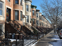
Streetscape in Bay Ridge
|
|
| Nickname(s): "The Ridge" | |
| Location of Bay Ridge | |
| Coordinates: 40°37′28″N 74°01′54″W / 40.6244160453°N 74.0316771125°W | |
| Country |
|
| State |
|
| City |
|
| Borough | Brooklyn |
| Government | |
| • Council Member | Vincent J. Gentile |
| • New York State Senator | Martin J. Golden |
| Area | |
| • Total | 2.12 sq mi (5.49 km2) |
| • Land | 2.12 sq mi (5.49 km2) |
| • Water | 0 sq mi (0 km2) |
| Population (2010) | |
| • Total | 79,371 |
| • Density | 37,000/sq mi (14,000/km2) |
| ZIP code | 11209, 11220 |
| Area code(s) | 347, 646, 718, 917, 929 |
Bay Ridge is a neighborhood in the southwest corner of the New York City borough of Brooklyn. It is bounded by Sunset Park on the north, Dyker Heights on the east, the Narrows and the Belt Parkway on the west, Fort Hamilton Army Base in the southeast corner, and the Verrazano Bridge on the south.
The first Dutch settlers began farming here in the 17th century. Well into the 19th century, what’s now considered Bay Ridge consisted of two sister villages: Yellow Hook to the north, named for the color of the soil, and Fort Hamilton to the south, named for the military installation at its center. The latter began to develop in the 1830s as a resort destination to lodge visitors to the army base. The former began to develop after 1850, when a group of artists moved to the area and founded a colony called Ovington Village; before that, it was mostly farmland.
In the 1850s, Historic Marker name to avoid association with yellow fever. "Bay Ridge" was suggested by local horticulturist James Weir after the area’s most prominent geographic features: the high ridge that offered views of New York Bay. The natural beauty attracted the wealthy, who built country homes along Shore Road, overlooking the water. By World War II, almost all of these large houses had been replaced with apartment buildings.
In the nineteenth and early twentieth centuries, many Norwegian and Danish sailors emigrated to Brooklyn, including Bay Ridge and neighboring Sunset Park; Lapskaus Boulevard, referring to the salted Norwegian beef stew, was the nickname of Eighth Avenue in this area. Development took off after the Fourth Avenue subway (today's R train) arrived in 1916, and accelerated through the 1920s, when the number of apartment buildings increased fivefold, replacing old farms, homesteads and houses.
...
Wikipedia


