Barry, Glamorgan
Barry
|
|
|---|---|
 A typical street in Romilly, All Saints Church pictured at the top of the hill. |
|
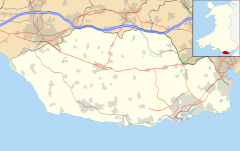
| Barry shown within the Vale of Glamorgan | |
| Population | 51,502 |
| OS grid reference | ST119682 |
| • Cardiff | 9.9 miles (15.9 km) |
| • London | 164.1 miles (264.1 km) |
| Community |
|
| Principal area | |
| Ceremonial county | |
| Country | Wales |
| Sovereign state | United Kingdom |
| Post town | BARRY |
| Postcode district | CF62–63 |
| Dialling code | 01446 |
| Police | South Wales |
| Fire | South Wales |
| Ambulance | Welsh |
| EU Parliament | Wales |
| UK Parliament | |
| Welsh Assembly | |
Barry (Welsh: Y Barri pronounced [ə ˈbarɪ]) is a town in the Vale of Glamorgan, Wales, on the north coast of the Bristol Channel approximately 7 miles (11 km) south-southwest of Cardiff. Barry is a seaside resort, with attractions including several beaches and the resurrected Barry Island Pleasure Park. According to the 2011 census, the population of Barry was 51,502, making it the fifth largest town in Wales.
Once a small village, Barry has absorbed its larger neighbouring villages of Cadoxton and Barry Island. It grew significantly from the 1880s with the development of Barry Docks, which in 1913 was the largest coal port in the world. The place was possibly named after Saint Baruc.
The area now occupied by Barry has seen human activity in many periods of history. Mesolithic or Middle Stone Age microlith flint tools have been found at Friars Point on Barry Island and near Wenvoe and Neolithic or New Stone Age polished stone axe-heads were discovered in St. Andrews Major. A cinerary urn (pottery urn buried with cremation ashes) was found on Barry Island during excavations of Bronze Age barrows and two more were found in a barrow at Cold Knap Point. A large defended enclosure or Iron Age promontory hillfort was located at the Bulwarks at Porthkerry and there was evidence of the existence of an early Iron Age farmstead during construction of Barry College off Colcot Road.
...
Wikipedia

