Barry Island
|
Barry Island Ynys y Barri |
|
|---|---|

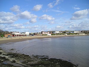
Looking across Whitmore Bay
|
|
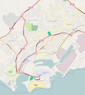
| Location in Barry | |
| Coordinates: 51°23′31.2″N 3°16′29.4″W / 51.392000°N 3.274833°W | |
| Country | Wales |
| County borough | Vale of Glamorgan |
| Town | Barry |
| Historic county | Glamorgan |
| Government | |
| • European Parliament | Wales |
| Time zone | GMT (UTC+0) |
| Post codes | CF62 |
| Area code(s) | 01446 |
Barry Island (Welsh: Ynys y Barri) is a district, peninsula and seaside resort, forming part of the town of Barry in the Vale of Glamorgan, South Wales. It is named after the 6th century Saint Baruc. Barry's stretch of coast, on the Bristol Channel, has the world's second highest tidal range of 15 metres (49 ft), second only to Bay of Fundy in Eastern Canada.
The peninsula was an island until the 1880s when it was linked to the mainland as the town of Barry expanded. This was partly due to the opening of Barry Docks by the Barry Railway Company. Established by David Davies, the docks now link up the gap which used to form Barry Island.
Although Barry Island used to be home to a Butlins Holiday Camp, it is now known more for its beach and Barry Island Pleasure Park. It was used as a setting of the BBC TV show Gavin and Stacey.
The area around Barry Island shows extensive evidence of human occupation. Mesolithic or Middle Stone Age microlith flint tools have been found at Friars Point on Barry Island and near Wenvoe, and Neolithic or New Stone Age polished stone axe-heads were discovered in St. Andrews Major. As the area was heavily wooded and movement would have been restricted, it is likely that people also came to what was to become Wales by boat, apparently from the Iberian Peninsula. They cleared the forests to establish pasture and to cultivate the land.
...
Wikipedia

