Barbentane
| Barbentane | ||
|---|---|---|

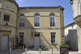
The old Town Hall
|
||
|
||
| Coordinates: 43°54′01″N 4°44′55″E / 43.9003°N 4.7486°ECoordinates: 43°54′01″N 4°44′55″E / 43.9003°N 4.7486°E | ||
| Country | France | |
| Region | Provence-Alpes-Côte d'Azur | |
| Department | Bouches-du-Rhône | |
| Arrondissement | Arles | |
| Canton | Châteaurenard | |
| Intercommunality | Agglomération Rhône Alpilles Durance | |
| Government | ||
| • Mayor (2001–2020) | Jean-Louis Ichartel | |
| Area1 | 27.13 km2 (10.47 sq mi) | |
| Population (2012)2 | 3,877 | |
| • Density | 140/km2 (370/sq mi) | |
| Time zone | CET (UTC+1) | |
| • Summer (DST) | CEST (UTC+2) | |
| INSEE/Postal code | 13010 / 13570 | |
| Elevation | 12–167 m (39–548 ft) (avg. 51 m or 167 ft) |
|
|
1 French Land Register data, which excludes lakes, ponds, glaciers > 1 km² (0.386 sq mi or 247 acres) and river estuaries. 2Population without double counting: residents of multiple communes (e.g., students and military personnel) only counted once. |
||
1 French Land Register data, which excludes lakes, ponds, glaciers > 1 km² (0.386 sq mi or 247 acres) and river estuaries.
Barbentane is a French commune of the Bouches-du-Rhône department in the Provence-Alpes-Côte d'Azur region of southern France.
The inhabitants of the commune are known as Barbentanais or Barbentanaises.
Barbentane is located at the northernmost point of the Bouches-du-Rhône department immediately south-west of Avignon near a rocky plateau and stretching a few kilometres across a flat low area and low hills where the urban area is located. The northern border of the commune is the departmental border between Bouches-du-Rhône and Vaucluse while the western border is the departmental border with Gard.
Access to the commune is by the D35 road from Rognonas in the east, which passes through the commune and the town and continues west, then south-west, to Boulbon. The D570N from Graveson in the south-east passes along the eastern border of the commune then goes east to Rognonas. The D34 goes east from the town to join the D570N. The D77D goes south-east from the town and also joins the D5470N. The D35E goes south from the village to join the D81 in the south. The main railway line from Avignon to the south passes through the east of the commune with the Barbentane-Rognonas Station east of the town. Apart from the town there are also the districts of La Chinquine, Carrière, Le Grand Roumette, Cambageon, Fontgisclar, La Bruyère, Bragalance, and Mas de Basette. The slopes in the south of the commune are forested while the rest of the commune is mostly farmland with an urban area of the of a significanltlysized town at the base of the slopes.
The north-western tip of the commune is the confluence of the Durance river, which forms the northern border of the commune, and the Rhône river, which forms the western border. The Canal des Alpines comes from the east and passes through the commune to continue south-west, parallel to the Rhône.
...
Wikipedia


