Baltimore–Washington region
| Baltimore–Washington Metropolitan Area |
|
|---|---|
| CSA | |

Baltimore's Inner Harbor
|
|
 The National Mall in Washington |
|
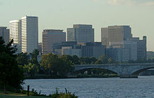
 Downtown Rosslyn in Arlington |
|
| Coordinates: 38°58′N 77°19′W / 38.97°N 77.32°WCoordinates: 38°58′N 77°19′W / 38.97°N 77.32°W | |
| Country |
|
| State | - - - - - |
| Principal cities |
Washington, D.C. Arlington, VA Alexandria, VA Baltimore, MD, Annapolis, MD Bethesda, MD Columbia, MD Easton, MD Falls Church, VA Frederick, MD Fredericksburg, VA Gaithersburg, MD Hagerstown, MD Lexington Park, MD Martinsburg, WV Rockville, MD Reston, VA Silver Spring, MD Towson, MD Waynesboro, PA Winchester, VA |
| Population (2013 est.) | |
| • CSA | 9,331,587(4th) |
| MSA/CSA = 2013 | |
| Time zone | EST (UTC-5) |
| • Summer (DST) | EST (UTC-4) |
The Baltimore–Washington metropolitan area is a combined statistical area consisting of the overlapping labor market region of the cities of Washington, D.C. and Baltimore, Maryland. The region includes Central Maryland, Northern Virginia, three counties in the Eastern Panhandle of West Virginia, and one county in South Central Pennsylvania. It is the most educated, highest-income, and fourth largest combined statistical area in the United States.
Officially, the area is designated by the Office of Management and Budget (OMB) as the Washington–Baltimore–Arlington, DC–MD–VA–WV–PA Combined Statistical Area. It is composed primarily of two major metropolitan statistical areas (MSA), the Washington–Arlington–Alexandria, DC–VA–MD–WV MSA and the Baltimore–Columbia–Towson, MD MSA. In addition, six other smaller urban areas not contiguous to the main urban area but having strong commuting ties with the main area are also included in the metropolitan area. These are: the Hagerstown–Martinsburg, MD–WV MSA, the Chambersburg–Waynesboro, PA MSA, the Winchester, VA–WV MSA, the California–Lexington Park, MD MSA, the Easton, MD micropolitan statistical area (µSA), and the Cambridge, MD µSA.
...
Wikipedia
