Dorchester County, MD
| Dorchester County, Maryland | ||
|---|---|---|

Dorchester County Courthouse
|
||
|
||
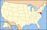
 Location in the U.S. state of Maryland |
||
 Maryland's location in the U.S. |
||
| Founded | 1669 | |
| Named for | Earl of Dorset | |
| Seat | Cambridge | |
| Largest city | Cambridge | |
| Area | ||
| • Total | 983 sq mi (2,546 km2) | |
| • Land | 541 sq mi (1,401 km2) | |
| • Water | 442 sq mi (1,145 km2), 45% | |
| Population (est.) | ||
| • (2015) | 32,384 | |
| • Density | 33/sq mi (13/km²) | |
| Congressional district | 1st | |
| Time zone | Eastern: UTC-5/-4 | |
| Website | www |
|
Coordinates: 38°25′N 76°05′W / 38.42°N 76.08°W
Dorchester County is a county located in the U.S. state of Maryland. As of the 2010 census, the population was 32,618. Its county seat is Cambridge. The county was formed in 1669 and named for the Earl of Dorset, a family friend of the Calverts (the founding family of the Maryland colony).
Dorchester County comprises the Cambridge, MD Micropolitan Statistical Area, which is also included in the Washington-Baltimore-Arlington, DC-MD-VA-WV-PA Combined Statistical Area. It is located on the Eastern Shore of Maryland.
Dorchester County is the largest county on the Eastern Shore. It is bordered by the Choptank River to the north, Talbot County to the northwest, Caroline County to the northeast, Wicomico County to the southeast, Sussex County, Delaware, to the east, and the Chesapeake Bay to the west. Dorchester County uses the slogan, "The Heart of Chesapeake Country," due to its geographical location and the heart-like shape of the county on a map.
...
Wikipedia

