Caroline County, Maryland
| Caroline County, Maryland | |||
|---|---|---|---|
| County | |||
| Caroline County | |||

The Caroline County Courthouse in July 2012
|
|||
|
|||
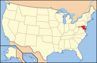
 Location in the U.S. state of Maryland |
|||
 Maryland's location in the U.S. |
|||
| Founded | 1774 | ||
| Named for | Caroline Eden | ||
| Seat | Denton | ||
| Largest town | Denton | ||
| Area | |||
| • Total | 326 sq mi (844 km2) | ||
| • Land | 319 sq mi (826 km2) | ||
| • Water | 6.5 sq mi (17 km2), 2.0% | ||
| Population (est.) | |||
| • (2015) | 32,579 | ||
| • Density | 99/sq mi (38/km²) | ||
| Congressional district | 1st | ||
| Time zone | Eastern: UTC-5/-4 | ||
| Website | www |
||
Coordinates: 38°52′N 75°49′W / 38.867°N 75.817°W
Caroline County is a rural county located in the U.S. state of Maryland on its Eastern Shore. As of the 2010 census, the population was 33,066. Its county seat is Denton.
Caroline County is bordered by Queen Anne's County to the north, Talbot County to the west, Dorchester County to the south, Kent County, Delaware, to the east, and Sussex County, Delaware, to the southeast.
Caroline County was created in 1774 from parts of Dorchester and Queen Anne's counties. The county derives its name from Lady Caroline Eden, wife of Maryland's last colonial governor, Robert Eden. At the time of its creation, seven commissioners were appointed: Charles Dickinson, Benson Stainton, Thomas White, William Haskins, Richard Mason, Joshua Clark, and Nathaniel Potter. These men bought 4 acres (1.6 ha) of land at Pig Point (now Denton) on which to build a courthouse and jail.
...
Wikipedia


