Balazuc
| Balazuc | ||
|---|---|---|

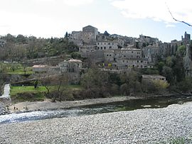
The Ardèche River in Balazuc
|
||
|
||
| Coordinates: 44°30′34″N 4°22′23″E / 44.5094°N 4.373°ECoordinates: 44°30′34″N 4°22′23″E / 44.5094°N 4.373°E | ||
| Country | France | |
| Region | Auvergne-Rhône-Alpes | |
| Department | Ardèche | |
| Arrondissement | Largentière | |
| Canton | Vallon-Pont-d'Arc | |
| Intercommunality | Gorges de l'Ardèche | |
| Government | ||
| • Mayor (2012–2020) | Bernard Constant | |
| Area1 | 18.9 km2 (7.3 sq mi) | |
| Population (2010)2 | 341 | |
| • Density | 18/km2 (47/sq mi) | |
| Time zone | CET (UTC+1) | |
| • Summer (DST) | CEST (UTC+2) | |
| INSEE/Postal code | 07023 / 07120 | |
| Elevation | 113–379 m (371–1,243 ft) (avg. 159 m or 522 ft) |
|
|
1 French Land Register data, which excludes lakes, ponds, glaciers > 1 km² (0.386 sq mi or 247 acres) and river estuaries. 2Population without double counting: residents of multiple communes (e.g., students and military personnel) only counted once. |
||
1 French Land Register data, which excludes lakes, ponds, glaciers > 1 km² (0.386 sq mi or 247 acres) and river estuaries.
Balazuc is a French commune in the Ardèche department in the Auvergne-Rhône-Alpes region of southern France.
The village has been labelled a "Village of Character" by the Departmental Committee of Tourism. It is a member of Les Plus Beaux Villages de France (The most beautiful villages in France) Association.
The inhabitants of the commune are known as Balazucains or Balazucaines.
Balazuc is located some 16 km south of Aubenas just east of Uzer. Aubenas Aerodrome is just north of the commune. Access to the commune is by the D579 road from Vogüé in the north which passes through the commune east of the village and continues to Pradons in the south. The D294 branches off the D579 in the commune and goes west to the village. Apart from the village there are also the hamlets of Servière, Translatour, Le Retourtier, and Les Louanes in the commune. The commune is forested in the west and east with large areas of farmland in the centre.
The Ardèche river flows through the commune and the village from north to south where it forms part of the southern border before continuing south to join the Rhône at Pont-Saint-Esprit. Numerous tributaries rise on both banks of the Ardèche and flow into the river including the Ruisseau de Mariou, the Ruisseau de Chadenas, the Ruisseau de Chastagnon, the Ruisseau de Tison, and the Ruisseau des Costes.
For millennia Balazuc has been the site of a ford on the Ardèche river which was a Gallic stronghold. The name Balazuc comes from the name Baladunum of bal meaning "rock" and "dunum" or "fortified height" in Gallic
...
Wikipedia


