Autrans
| Autrans | ||
|---|---|---|
 |
||
|
||
| Coordinates: 45°10′34″N 5°32′31″E / 45.176°N 5.542°ECoordinates: 45°10′34″N 5°32′31″E / 45.176°N 5.542°E | ||
| Country | France | |
| Region | Auvergne-Rhône-Alpes | |
| Department | Isère | |
| Arrondissement | Grenoble | |
| Canton | Fontaine-Vercors | |
| Intercommunality | Massif du Vercors | |
| Government | ||
| • Mayor (2014–2020) | Thierry Gamot | |
| Area1 | 44 km2 (17 sq mi) | |
| Population (2010)2 | 1,702 | |
| • Density | 39/km2 (100/sq mi) | |
| Time zone | CET (UTC+1) | |
| • Summer (DST) | CEST (UTC+2) | |
| INSEE/Postal code | 38021 / 38880 | |
| Elevation | 1,005–1,711 m (3,297–5,614 ft) | |
|
1 French Land Register data, which excludes lakes, ponds, glaciers > 1 km² (0.386 sq mi or 247 acres) and river estuaries. 2Population without double counting: residents of multiple communes (e.g., students and military personnel) only counted once. |
||
1 French Land Register data, which excludes lakes, ponds, glaciers > 1 km² (0.386 sq mi or 247 acres) and river estuaries.
Autrans is a former commune in the Isère department in the Rhône-Alpes region of south-eastern France. On 1 January 2016, it was merged into the new commune of Autrans-Méaudre-en-Vercors.
At the 1968 Winter Olympics in Grenoble, it hosted the biathlon, cross country skiing, Nordic combined, and the ski jumping normal hill events.
The inhabitants of the commune are known as Autranais or Autranaises.
The commune has been awarded one flower by the National Council of Towns and Villages in Bloom in the Competition of cities and villages in Bloom.
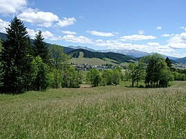
Autrans is located on the Vercors Plateau in the Vercors Regional Natural Park some 10 km west of Grenoble and 11 km east of Vinay. Access to the commune is solely by the D106C which branches north from the D106 and passes in a loop through the village then back south to Méaudre. A local road goes north from the village along to the valley to the ski fields in the north of the commune. There is farmland in the valley but the slopes of the surrounding mountains are rugged and heavily forested.
The Meaudret rises in the north of the commune and flows south down the valley through the village and continues south to join the Bourne at Les Jarrands.
...
Wikipedia


